Mādārīpur night lights from space
Night Light of Mādārīpur (Dhaka) from space (Bangladesh) Src. Average luminocity for 10x10km area is 7.178% and for 50x50km: 0.9022%.
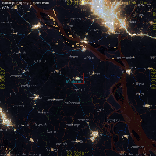

Analysis of Mādārīpur night lights 2016
Square area 10x10 km:
 0%
0%90-99
0%80-89
1.52%70-79
0.57%60-69
2.27%50-59
0.95%40-49
0.38%30-39
3.41%20-29
3.41%10-19
1.89%0-9
85.61%Square area 50x50 km:
0%90-99
0%80-89
0.06%70-79
0.05%60-69
0.22%50-59
0.09%40-49
0.21%30-39
0.4%20-29
0.62%10-19
0.38%0-9
97.97%Clear (daylight) street map image can be seen on geolist.org.
Map coordinates:
23° 48' 56.9" North, 89° 30' 22.4" East
23° 10' 15.5" North, 90° 12' 33.7" East
22° 31' 22.8" North, 90° 54' 44.9" East
Some cities around Mādārīpur sort by population:
• Nārāyanganj
57.6 km =35.8 mi,  31°
31°
• Barisāl
54.4 km =33.8 mi,  162°
162°
• Pālang
15.4 km =9.6 mi,  70°
70°
• Tungipāra
43.5 km =27 mi,  226°
226°
• Dohār
47.4 km =29.5 mi,  351°
351°
• Gaurnadi
22 km =13.7 mi,  176°
176°
• Mehendiganj
50.7 km =31.5 mi,  139°
139°
• Char Bhadrāsan
15.5 km =9.6 mi,  6°
6°
1337245 (p: 84,789)
Sources (retrieved 2019-11-25):
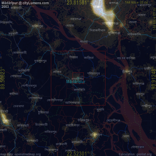
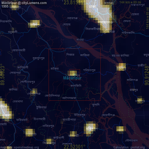
» NASA, Earths city lights 1995
» NASA city lights 2003
» Earth at Night: Flat Maps 2012, 2016