Xudat night lights from space
Night Light of Xudat (Xaçmaz) from space (Azerbaijan) Src. Average luminocity for 10x10km area is 2.0341% and for 50x50km: 1.4094%.
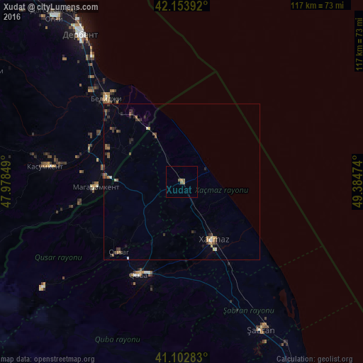
Analysis of Xudat night lights 2016
Square area 10x10 km:
 0%
0%90-99
0%80-89
0%70-79
0%60-69
1.3%50-59
1.95%40-49
0%30-39
0%20-29
0%10-19
0%0-9
96.75%Square area 50x50 km:
0.03%90-99
0.16%80-89
0.06%70-79
0.15%60-69
0.22%50-59
0.47%40-49
0.21%30-39
0.39%20-29
0.48%10-19
0.15%0-9
97.68%Clear (daylight) street map image can be seen on geolist.org.
Map coordinates:
42° 9' 14.1" North, 47° 58' 42.6" East
41° 37' 49.9" North, 48° 40' 53.8" East
41° 6' 10.2" North, 49° 23' 5.1" East
Some cities around Xudat sort by population:
• Derbent, RU
58.5 km =36.4 mi,  326°
326°
• Xaçmaz
21.2 km =13.2 mi,  150°
150°
• Divichibazar
54.1 km =33.6 mi, 151°
• Quba
33.1 km =20.6 mi,  205°
205°
• Belidzhi, RU
36.6 km =22.7 mi,  322°
322°
• Qusar
30.8 km =19.1 mi,  222°
222°
• Kasumkent, RU
44.8 km =27.8 mi,  276°
276°
• Magaramkent, RU
27.8 km =17.3 mi,  266°
266°
584715 (p: 13,625)
Sources (retrieved 2019-11-25):
» Earth at Night: Flat Maps 2012, 2016