Şirvan night lights from space
Night Light of Şirvan (Shirvan) from space (Azerbaijan) Src. Average luminocity for 10x10km area is 26.8163% and for 50x50km: 2.9763%.
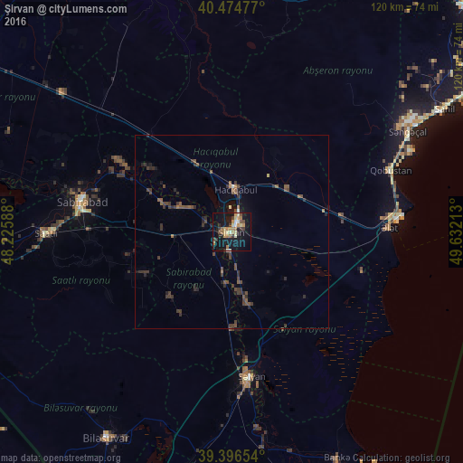
Analysis of Şirvan night lights 2016
Square area 10x10 km:
 1.53%
1.53%90-99
3.06%80-89
4.93%70-79
3.4%60-69
6.63%50-59
2.55%40-49
3.74%30-39
4.08%20-29
2.21%10-19
32.31%0-9
35.54%Square area 50x50 km:
0.07%90-99
0.21%80-89
0.22%70-79
0.17%60-69
0.43%50-59
0.65%40-49
0.92%30-39
1.08%20-29
1%10-19
1.91%0-9
93.34%Clear (daylight) street map image can be seen on geolist.org.
Map coordinates:
40° 28' 29.2" North, 48° 13' 33.2" East
39° 56' 16" North, 48° 55' 44.4" East
39° 23' 47.5" North, 49° 37' 55.7" East
Some cities around Şirvan sort by population:
• Saatlı
47.8 km =29.7 mi,  269°
269°
• Salyan
38.3 km =23.8 mi,  172°
172°
• Sabirabad
39.3 km =24.4 mi,  281°
281°
• Hacıqabul
11.3 km =7 mi,  6°
6°
• Pushkino
62.6 km =38.9 mi,  211°
211°
• Əhmədbəyli
46.3 km =28.8 mi,  262°
262°
• Qobustan
44.2 km =27.5 mi,  68°
68°
• Severo-Vostotchnyi Bank
64.6 km =40.1 mi,  155°
155°
148565 (p: 70,220)
Sources (retrieved 2019-11-25):
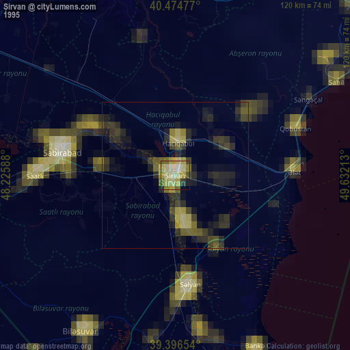
» NASA, Earths city lights 1995
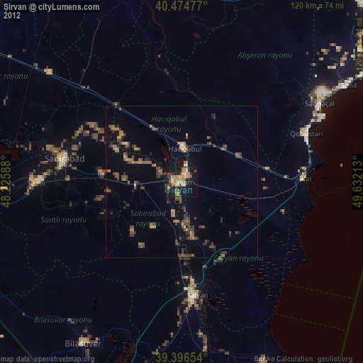
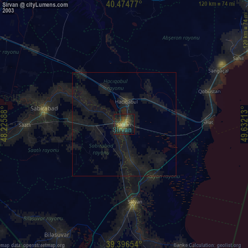
» NASA city lights 2003
» Earth at Night: Flat Maps 2012, 2016