Sabirabad night lights from space
Night Light of Sabirabad from space (Azerbaijan) Src. Average luminocity for 10x10km area is 24.7806% and for 50x50km: 2.5426%.
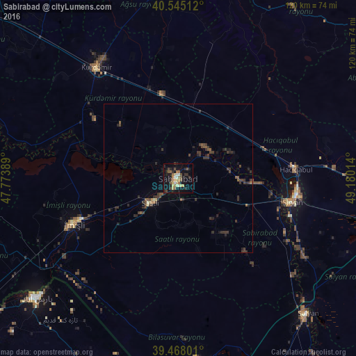
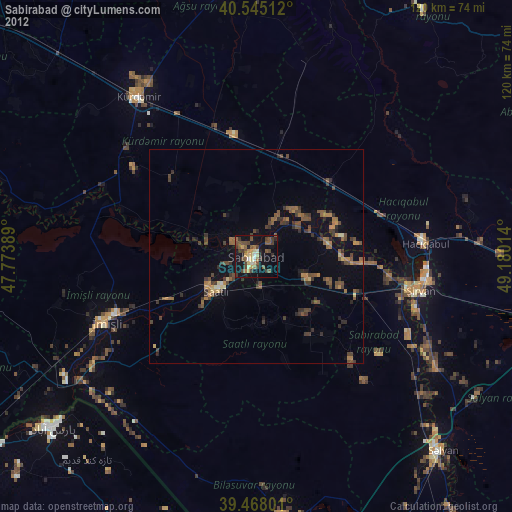
Analysis of Sabirabad night lights 2016
Square area 10x10 km:
 0.51%
0.51%90-99
3.57%80-89
3.4%70-79
4.25%60-69
3.23%50-59
4.25%40-49
5.27%30-39
2.72%20-29
6.63%10-19
27.38%0-9
38.78%Square area 50x50 km:
0.02%90-99
0.16%80-89
0.23%70-79
0.19%60-69
0.24%50-59
0.51%40-49
0.72%30-39
1.12%20-29
1.05%10-19
1.49%0-9
94.27%Clear (daylight) street map image can be seen on geolist.org.
Map coordinates:
40° 32' 42.4" North, 47° 46' 26" East
40° 0' 31.3" North, 48° 28' 37.2" East
39° 28' 4.8" North, 49° 10' 48.5" East
Some cities around Sabirabad sort by population:
• Pārsābād, IR
62.4 km =38.8 mi,  230°
230°
• Saatlı
12.5 km =7.8 mi, 227°
• Şirvan
39.3 km =24.4 mi,  101°
101°
• Imishli
38.7 km =24 mi,  246°
246°
• Hacıqabul
39.8 km =24.7 mi,  85°
85°
• Kyurdarmir
46 km =28.6 mi,  323°
323°
• Pushkino
61.5 km =38.2 mi,  174°
174°
• Əhmədbəyli
16 km =9.9 mi,  207°
207°
585187 (p: 28,075)
Sources (retrieved 2019-11-25):
» Earth at Night: Flat Maps 2012, 2016