Saatlı night lights from space
Night Light of Saatlı from space (Azerbaijan) Src. Average luminocity for 10x10km area is 14.017% and for 50x50km: 2.4145%.
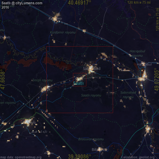
Analysis of Saatlı night lights 2016
Square area 10x10 km:
 0%
0%90-99
0.68%80-89
2.72%70-79
0.68%60-69
1.53%50-59
3.23%40-49
3.74%30-39
5.95%20-29
4.08%10-19
1.36%0-9
76.02%Square area 50x50 km:
0.05%90-99
0.18%80-89
0.26%70-79
0.25%60-69
0.18%50-59
0.4%40-49
0.6%30-39
0.87%20-29
0.9%10-19
1.46%0-9
94.84%Clear (daylight) street map image can be seen on geolist.org.
Map coordinates:
40° 28' 9" North, 47° 39' 56.9" East
39° 55' 55.7" North, 48° 22' 8.1" East
39° 23' 27.1" North, 49° 4' 19.4" East
Some cities around Saatlı sort by population:
• Pārsābād, IR
49.8 km =30.9 mi,  230°
230°
• Şirvan
47.8 km =29.7 mi,  89°
89°
• Imishli
27.2 km =16.9 mi,  255°
255°
• Sabirabad
12.5 km =7.8 mi,  47°
47°
• Hacıqabul
50.3 km =31.3 mi,  76°
76°
• Kyurdarmir
49.1 km =30.5 mi,  338°
338°
• Pushkino
54.8 km =34.1 mi,  164°
164°
• Əhmədbəyli
6 km =3.7 mi, 161°
147288 (p: 87,000)
Sources (retrieved 2019-11-25):
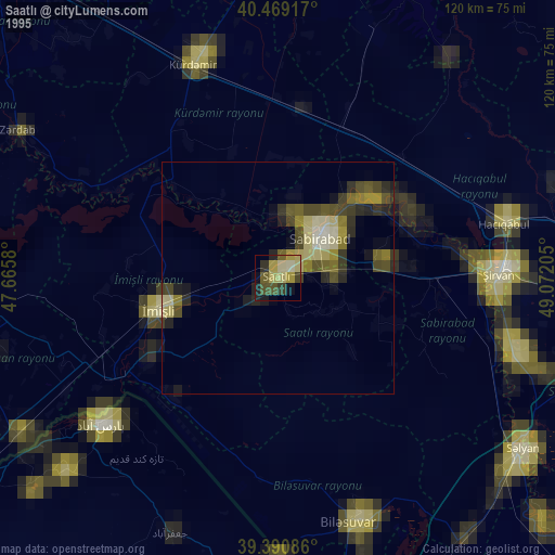
» NASA, Earths city lights 1995
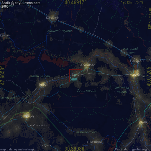
» NASA city lights 2003
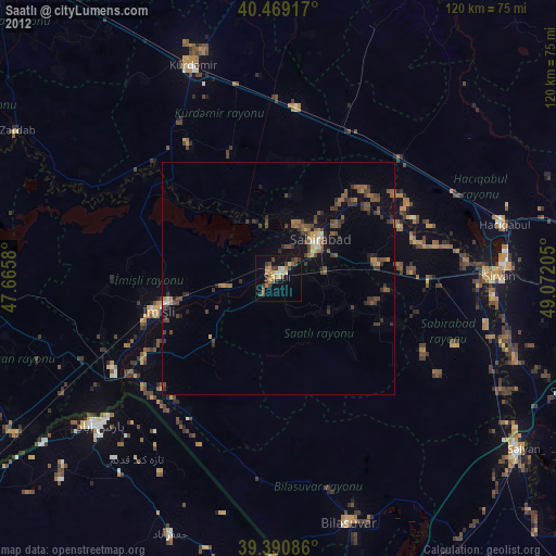
» Earth at Night: Flat Maps 2012, 2016