Saray night lights from space
Night Light of Saray (Abşeron) from space (Azerbaijan) Src. Average luminocity for 10x10km area is 58.682% and for 50x50km: 27.5319%.
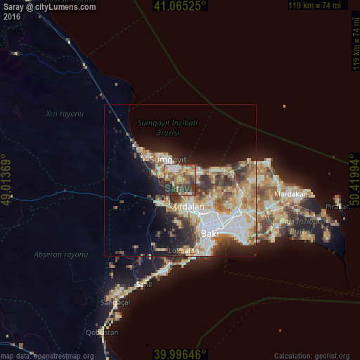
Analysis of Saray night lights 2016
Square area 10x10 km:
 5.1%
5.1%90-99
8.33%80-89
7.48%70-79
13.95%60-69
13.44%50-59
11.73%40-49
12.41%30-39
16.67%20-29
10.88%10-19
0%0-9
0%Square area 50x50 km:
5.39%90-99
5.45%80-89
3.84%70-79
4.21%60-69
4.41%50-59
3.43%40-49
2.91%30-39
4.21%20-29
5.19%10-19
8.88%0-9
52.09%Clear (daylight) street map image can be seen on geolist.org.
Map coordinates:
41° 3' 54.9" North, 49° 0' 49.3" East
40° 31' 58.8" North, 49° 43' 0.5" East
39° 59' 47.3" North, 50° 25' 11.8" East
Some cities around Saray sort by population:
• Sumqayıt
7.5 km =4.7 mi,  327°
327°
• Bilajari
12.4 km =7.7 mi,  142°
142°
• Khirdalan
10 km =6.2 mi,  161°
161°
• Binagadi
12 km =7.5 mi,  128°
128°
• Corat
4.4 km =2.7 mi,  347°
347°
• Qobu
14.3 km =8.9 mi,  181°
181°
• Ceyranbatan
4.8 km =3 mi,  281°
281°
• Khodzhi-Gasan
14.1 km =8.8 mi, 161°
585145 (p: 10,173)
Sources (retrieved 2019-11-25):
» Earth at Night: Flat Maps 2012, 2016