Sumqayıt night lights from space
Night Light of Sumqayıt (Sumqayit) from space (Azerbaijan) Src. Average luminocity for 10x10km area is 57.737% and for 50x50km: 20.7046%.
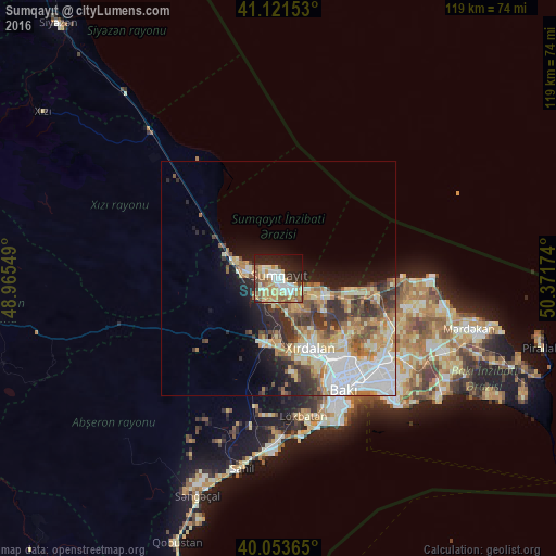
Analysis of Sumqayıt night lights 2016
Square area 10x10 km:
 10.71%
90-99
12.82%80-89
11.04%70-79
9.74%60-69
7.31%50-59
8.77%40-49
2.11%30-39
3.9%20-29
17.21%10-19
13.8%0-9
2.6%Square area 50x50 km:
4.38%90-99
4.13%80-89
2.68%70-79
3.12%60-69
3.16%50-59
2.41%40-49
2.28%30-39
3.46%20-29
3.83%10-19
6.1%0-9
64.46%Clear (daylight) street map image can be seen on geolist.org.
Map coordinates:
41° 7' 17.5" North, 48° 57' 55.8" East
40° 35' 23" North, 49° 40' 7" East
40° 3' 13.1" North, 50° 22' 18.3" East
Some cities around Sumqayıt sort by population:
• Bilajari
19.9 km =12.4 mi,  144°
144°
• Khirdalan
17.4 km =10.8 mi,  155°
155°
• Hacı Zeynalabdin
10 km =6.2 mi,  291°
291°
• Binagadi
19.2 km =11.9 mi, 135°
• Saray
7.5 km =4.7 mi,  147°
147°
• Corat
3.7 km =2.3 mi,  122°
122°
• Qobu
20.9 km =13 mi,  169°
169°
• Ceyranbatan
5.4 km =3.4 mi,  187°
187°
584923 (p: 265,150)
Sources (retrieved 2019-11-25):
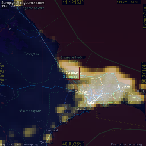
» NASA, Earths city lights 1995
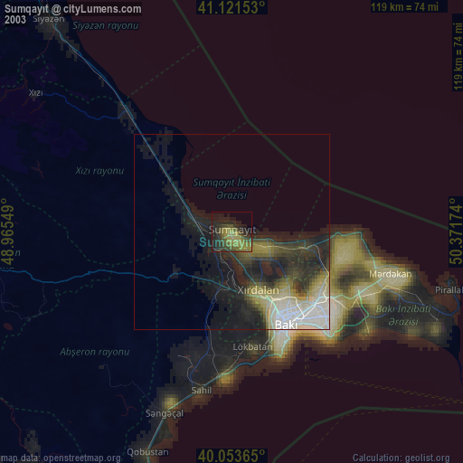
» NASA city lights 2003
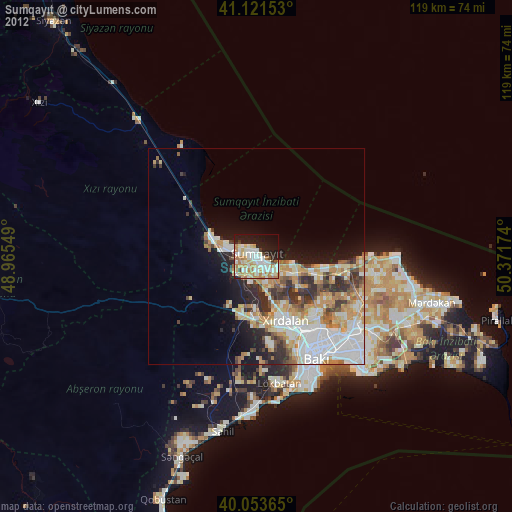
» Earth at Night: Flat Maps 2012, 2016