Corat night lights from space
Night Light of Corat (Sumqayit) from space (Azerbaijan) Src. Average luminocity for 10x10km area is 60.026% and for 50x50km: 24.1144%.
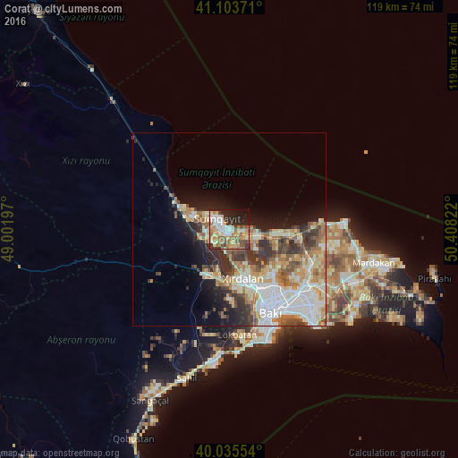
Analysis of Corat night lights 2016
Square area 10x10 km:
 9.42%
9.42%90-99
13.64%80-89
8.12%70-79
14.12%60-69
10.06%50-59
7.31%40-49
6.33%30-39
5.19%20-29
14.61%10-19
9.74%0-9
1.46%Square area 50x50 km:
5.03%90-99
4.83%80-89
3.27%70-79
3.66%60-69
3.83%50-59
2.99%40-49
2.67%30-39
3.7%20-29
4.06%10-19
6.67%0-9
59.3%Clear (daylight) street map image can be seen on geolist.org.
Map coordinates:
41° 6' 13.4" North, 49° 0' 7.1" East
40° 34' 18.3" North, 49° 42' 18.3" East
40° 2' 7.9" North, 50° 24' 29.6" East
Some cities around Corat sort by population:
• Sumqayıt
3.7 km =2.3 mi,  302°
302°
• Bilajari
16.5 km =10.3 mi,  149°
149°
• Khirdalan
14.4 km =8.9 mi,  162°
162°
• Hacı Zeynalabdin
13.6 km =8.5 mi,  294°
294°
• Binagadi
15.7 km =9.8 mi,  138°
138°
• Saray
4.4 km =2.7 mi,  167°
167°
• Ceyranbatan
5 km =3.1 mi,  228°
228°
• Khodzhi-Gasan
18.5 km =11.5 mi, 162°
586631 (p: 8,624)
Sources (retrieved 2019-11-25):
» Earth at Night: Flat Maps 2012, 2016