Imishli night lights from space
Night Light of Imishli (İmişli) from space (Azerbaijan) Src. Average luminocity for 10x10km area is 16.2755% and for 50x50km: 1.8945%.
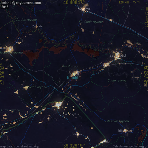
Analysis of Imishli night lights 2016
Square area 10x10 km:
 0.85%
0.85%90-99
0.51%80-89
2.21%70-79
3.57%60-69
4.59%50-59
3.23%40-49
0.68%30-39
2.72%20-29
3.06%10-19
3.06%0-9
75.51%Square area 50x50 km:
0.14%90-99
0.1%80-89
0.11%70-79
0.2%60-69
0.29%50-59
0.35%40-49
0.26%30-39
0.61%20-29
0.75%10-19
0.93%0-9
96.25%Clear (daylight) street map image can be seen on geolist.org.
Map coordinates:
40° 24' 30.5" North, 47° 21' 24.6" East
39° 52' 15.4" North, 48° 3' 35.8" East
39° 19' 45.1" North, 48° 45' 47.1" East
Some cities around Imishli sort by population:
• Pārsābād, IR
27.6 km =17.1 mi,  206°
206°
• Saatlı
27.2 km =16.9 mi,  75°
75°
• Sabirabad
38.7 km =24 mi,  66°
66°
• Kyurdarmir
53.1 km =33 mi,  8°
8°
• Əhmədbəyli
28.3 km =17.6 mi,  87°
87°
• Beylagan
39.2 km =24.4 mi,  254°
254°
• Zardob
48.7 km =30.3 mi,  322°
322°
• Dünyamalılar
27.9 km =17.3 mi, 246°
147982 (p: 34,178)
Sources (retrieved 2019-11-25):
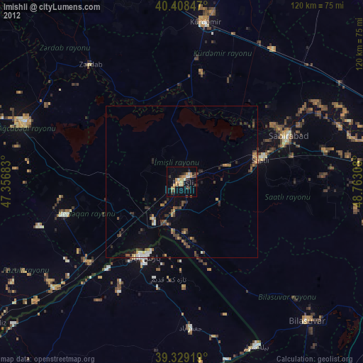
» Earth at Night: Flat Maps 2012, 2016