Beylagan night lights from space
Night Light of Beylagan (Beyləqan) from space (Azerbaijan) Src. Average luminocity for 10x10km area is 8.2109% and for 50x50km: 2.4874%.
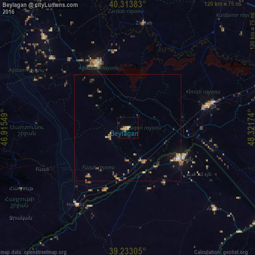
Analysis of Beylagan night lights 2016
Square area 10x10 km:
 0%
0%90-99
0.34%80-89
1.7%70-79
2.89%60-69
1.87%50-59
0.68%40-49
1.19%30-39
0.17%20-29
1.36%10-19
1.02%0-9
88.78%Square area 50x50 km:
0.09%90-99
0.11%80-89
0.31%70-79
0.54%60-69
0.45%50-59
0.33%40-49
0.59%30-39
0.46%20-29
0.47%10-19
1.01%0-9
95.63%Clear (daylight) street map image can be seen on geolist.org.
Map coordinates:
40° 18' 49.8" North, 46° 54' 55.8" East
39° 46' 32" North, 47° 37' 7" East
39° 13' 59" North, 48° 19' 18.3" East
Some cities around Beylagan sort by population:
• Pārsābād, IR
29.2 km =18.1 mi,  118°
118°
• Agdzhabedy
33.4 km =20.8 mi,  336°
336°
• Imishli
39.2 km =24.4 mi,  74°
74°
• Fizuli
44.9 km =27.9 mi,  244°
244°
• Zardob
49.9 km =31 mi,  9°
9°
• Dünyamalılar
12 km =7.5 mi,  91°
91°
• Avşar
27.6 km =17.1 mi,  323°
323°
• Novyy Karanlug
43.4 km =27 mi,  272°
272°
148354 (p: 15,599)
Sources (retrieved 2019-11-25):
» Earth at Night: Flat Maps 2012, 2016