Yarraville night lights from space
Night Light of Yarraville (Victoria) from space (Australia) Src. Average luminocity for 10x10km area is 95.8282% and for 50x50km: 51.6869%.
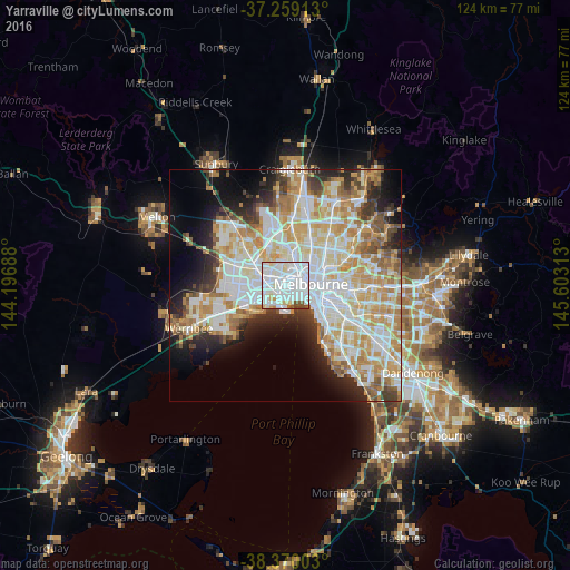
Analysis of Yarraville night lights 2016
Square area 10x10 km:
 58.5%
58.5%90-99
30.1%80-89
5.27%70-79
1.36%60-69
0.51%50-59
2.89%40-49
1.36%30-39
0%20-29
0%10-19
0%0-9
0%Square area 50x50 km:
14.21%90-99
13.07%80-89
6.8%70-79
8.85%60-69
6.44%50-59
4.24%40-49
3.4%30-39
3.64%20-29
6.11%10-19
8.39%0-9
24.85%Clear (daylight) street map image can be seen on geolist.org.
Map coordinates:
37° 15' 32.9" South, 144° 11' 48.8" East
37° 49' 0" South, 144° 54' 0" East
38° 22' 12.1" South, 145° 36' 11.3" East
Some cities around Yarraville sort by population:
• Footscray
1.9 km =1.2 mi,  0°
0°
• North Melbourne
4.5 km =2.8 mi,  62°
62°
• Newport
3.3 km =2.1 mi,  203°
203°
• Docklands
4.4 km =2.7 mi,  87°
87°
• West Footscray
2.9 km =1.8 mi,  316°
316°
• Kensington
3.9 km =2.4 mi,  44°
44°
• Flemington
4.1 km =2.5 mi, 39°
• Seddon
1.4 km =0.9 mi,  325°
325°
2142457 (p: 14,733)
Sources (retrieved 2019-11-25):
» Earth at Night: Flat Maps 2012, 2016