Flemington night lights from space
Night Light of Flemington (Victoria) from space (Australia) Src. Average luminocity for 10x10km area is 97.131% and for 50x50km: 54.068%.
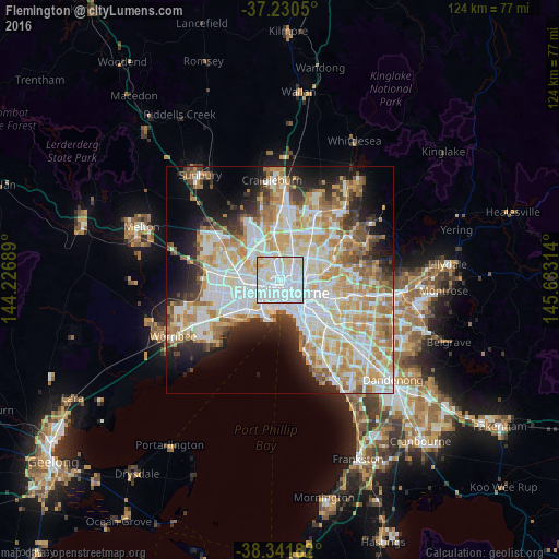
Analysis of Flemington night lights 2016
Square area 10x10 km:
 61.56%
90-99
25%80-89
11.73%70-79
1.7%60-69
0%50-59
0%40-49
0%30-39
0%20-29
0%10-19
0%0-9
0%Square area 50x50 km:
14.75%90-99
13.59%80-89
6.92%70-79
9.34%60-69
7.23%50-59
4.51%40-49
3.61%30-39
3.54%20-29
6.21%10-19
9.17%0-9
21.12%Clear (daylight) street map image can be seen on geolist.org.
Map coordinates:
37° 13' 49.8" South, 144° 13' 36.8" East
37° 47' 17.7" South, 144° 55' 48" East
38° 20' 30.6" South, 145° 37' 59.3" East
Some cities around Flemington sort by population:
• Footscray
2.9 km =1.8 mi,  243°
243°
• North Melbourne
1.7 km =1.1 mi,  129°
129°
• Ascot Vale
1.1 km =0.7 mi,  325°
325°
• Moonee Ponds
2.7 km =1.7 mi, 333°
• Brunswick West
2.9 km =1.8 mi,  24°
24°
• Kensington
0.4 km =0.2 mi,  166°
166°
• Parkville
1.8 km =1.1 mi,  72°
72°
• West Melbourne
3 km =1.9 mi,  144°
144°
9972408 (p: 7,737)
Sources (retrieved 2019-11-25):
» Earth at Night: Flat Maps 2012, 2016