West Footscray night lights from space
Night Light of West Footscray (Victoria) from space (Australia) Src. Average luminocity for 10x10km area is 96.8861% and for 50x50km: 50.8207%.
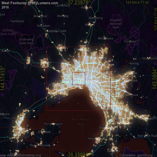
Analysis of West Footscray night lights 2016
Square area 10x10 km:
 51.19%
90-99
36.39%80-89
8.84%70-79
3.57%60-69
0%50-59
0%40-49
0%30-39
0%20-29
0%10-19
0%0-9
0%Square area 50x50 km:
14.02%90-99
12.82%80-89
6.48%70-79
8.52%60-69
6.22%50-59
4.33%40-49
3.5%30-39
3.4%20-29
6.03%10-19
9.63%0-9
25.04%Clear (daylight) street map image can be seen on geolist.org.
Map coordinates:
37° 14' 23.2" South, 144° 10' 26.9" East
37° 47' 50.9" South, 144° 52' 38.2" East
38° 21' 3.5" South, 145° 34' 49.4" East
Some cities around West Footscray sort by population:
• Footscray
2 km =1.2 mi,  98°
98°
• Yarraville
2.9 km =1.8 mi,  136°
136°
• Maribyrnong
2.9 km =1.8 mi,  12°
12°
• Avondale Heights
4.2 km =2.6 mi,  342°
342°
• Sunshine
4.2 km =2.6 mi,  292°
292°
• Braybrook
2.3 km =1.4 mi,  301°
301°
• Maidstone
1.9 km =1.2 mi,  350°
350°
• Seddon
1.5 km =0.9 mi,  129°
129°
9972583 (p: 11,347)
Sources (retrieved 2019-11-25):
» Earth at Night: Flat Maps 2012, 2016