Newport night lights from space
Night Light of Newport (Victoria) from space (Australia) Src. Average luminocity for 10x10km area is 77.1735% and for 50x50km: 49.2661%.
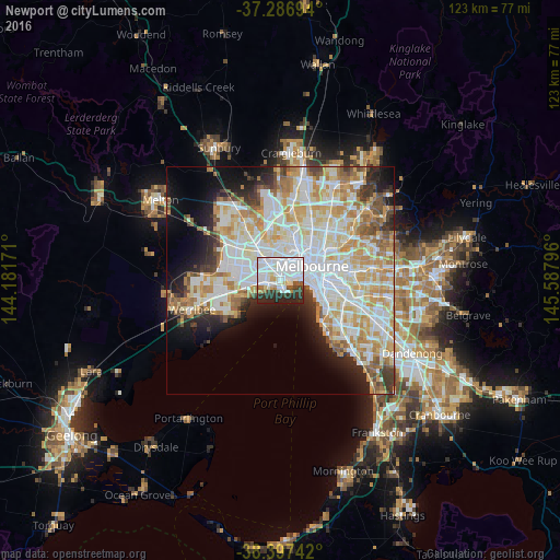
Analysis of Newport night lights 2016
Square area 10x10 km:
 37.76%
90-99
22.62%80-89
3.91%70-79
3.06%60-69
2.72%50-59
3.57%40-49
3.06%30-39
9.69%20-29
13.27%10-19
0.34%0-9
0%Square area 50x50 km:
13.87%90-99
12.67%80-89
6.62%70-79
8.21%60-69
5.76%50-59
4.06%40-49
3.02%30-39
3.35%20-29
5.31%10-19
8.2%0-9
28.94%Clear (daylight) street map image can be seen on geolist.org.
Map coordinates:
37° 17' 13" South, 144° 10' 54.2" East
37° 50' 39.4" South, 144° 53' 5.4" East
38° 23' 50.7" South, 145° 35' 16.7" East
Some cities around Newport sort by population:
• Footscray
5.1 km =3.2 mi,  15°
15°
• Port Melbourne
5.1 km =3.2 mi,  84°
84°
• Yarraville
3.3 km =2.1 mi, 23°
• Williamstown
2.5 km =1.6 mi,  149°
149°
• Altona North
3.5 km =2.2 mi,  287°
287°
• West Footscray
5.2 km =3.2 mi,  352°
352°
• Altona
5.6 km =3.5 mi,  239°
239°
• Seddon
4.3 km =2.7 mi,  6°
6°
2155411 (p: 12,751)
Sources (retrieved 2019-11-25):
» Earth at Night: Flat Maps 2012, 2016