Sunshine night lights from space
Night Light of Sunshine (Victoria) from space (Australia) Src. Average luminocity for 10x10km area is 94.619% and for 50x50km: 47.059%.
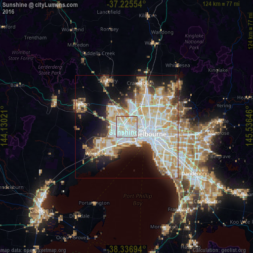
Analysis of Sunshine night lights 2016
Square area 10x10 km:
 38.61%
90-99
37.76%80-89
16.84%70-79
6.8%60-69
0%50-59
0%40-49
0%30-39
0%20-29
0%10-19
0%0-9
0%Square area 50x50 km:
13.28%90-99
11.71%80-89
6.06%70-79
7.54%60-69
5.48%50-59
3.78%40-49
3.02%30-39
3.35%20-29
5.71%10-19
10.08%0-9
29.99%Clear (daylight) street map image can be seen on geolist.org.
Map coordinates:
37° 13' 31.9" South, 144° 7' 48.8" East
37° 46' 60" South, 144° 49' 60" East
38° 20' 13" South, 145° 32' 11.3" East
Some cities around Sunshine sort by population:
• St Albans
5.2 km =3.2 mi,  325°
325°
• Maribyrnong
4.6 km =2.9 mi,  74°
74°
• Avondale Heights
3.5 km =2.2 mi,  46°
46°
• West Footscray
4.2 km =2.6 mi,  112°
112°
• Cairnlea
4.8 km =3 mi,  303°
303°
• Braybrook
1.9 km =1.2 mi,  101°
101°
• Maidstone
3.5 km =2.2 mi,  84°
84°
• Seddon
5.6 km =3.5 mi,  116°
116°
2147864 (p: 9,558)
Sources (retrieved 2019-11-25):
» Earth at Night: Flat Maps 2012, 2016