Cairnlea night lights from space
Night Light of Cairnlea (Victoria) from space (Australia) Src. Average luminocity for 10x10km area is 87.4116% and for 50x50km: 42.3274%.
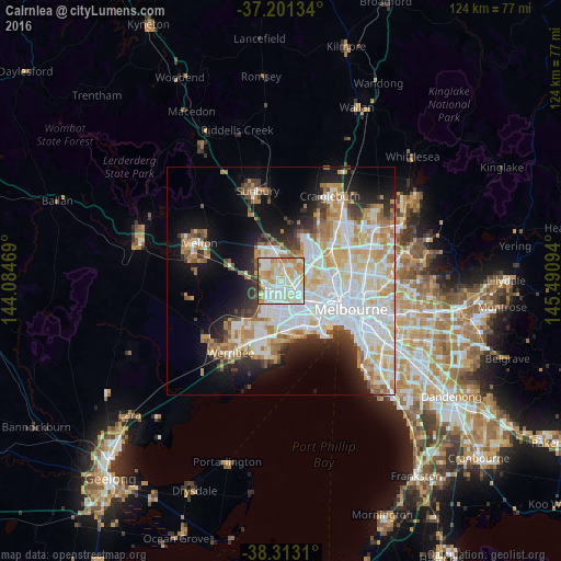
Analysis of Cairnlea night lights 2016
Square area 10x10 km:
 22.96%
90-99
31.97%80-89
18.03%70-79
16.16%60-69
7.14%50-59
2.04%40-49
1.36%30-39
0.34%20-29
0%10-19
0%0-9
0%Square area 50x50 km:
12.62%90-99
10.47%80-89
5.12%70-79
5.94%60-69
4.68%50-59
3.26%40-49
2.69%30-39
3.06%20-29
5.46%10-19
10.56%0-9
36.15%Clear (daylight) street map image can be seen on geolist.org.
Map coordinates:
37° 12' 4.8" South, 144° 5' 4.9" East
37° 45' 33.5" South, 144° 47' 16.1" East
38° 18' 47.2" South, 145° 29' 27.4" East
Some cities around Cairnlea sort by population:
• St Albans
1.9 km =1.2 mi,  34°
34°
• Saint Albans
3.1 km =1.9 mi,  20°
20°
• Sunshine West
4.3 km =2.7 mi,  144°
144°
• Deer Park
2.1 km =1.3 mi,  244°
244°
• Sunshine North
3.7 km =2.3 mi,  108°
108°
• Derrimut
4 km =2.5 mi,  203°
203°
• Kings Park
3 km =1.9 mi,  342°
342°
• Albanvale
2.2 km =1.4 mi,  310°
310°
8349376 (p: 9,653)
Sources (retrieved 2019-11-25):
» Earth at Night: Flat Maps 2012, 2016