Braybrook night lights from space
Night Light of Braybrook (Victoria) from space (Australia) Src. Average luminocity for 10x10km area is 95.0816% and for 50x50km: 49.0194%.
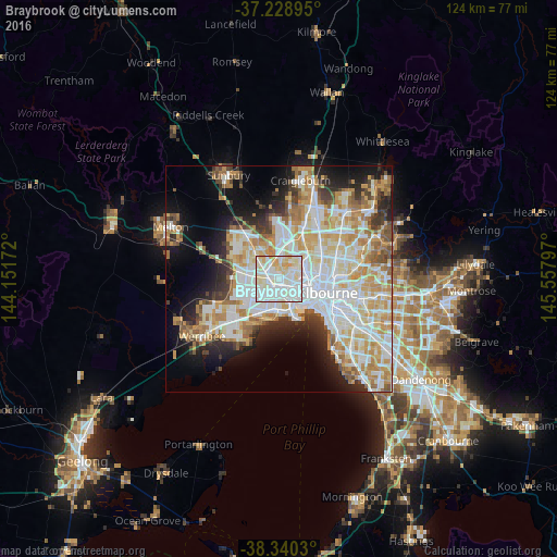
Analysis of Braybrook night lights 2016
Square area 10x10 km:
 39.97%
90-99
38.44%80-89
16.33%70-79
5.27%60-69
0%50-59
0%40-49
0%30-39
0%20-29
0%10-19
0%0-9
0%Square area 50x50 km:
13.57%90-99
12.28%80-89
6.35%70-79
8.08%60-69
5.79%50-59
4.14%40-49
3.22%30-39
3.41%20-29
5.98%10-19
9.82%0-9
27.35%Clear (daylight) street map image can be seen on geolist.org.
Map coordinates:
37° 13' 44.2" South, 144° 9' 6.2" East
37° 47' 12.2" South, 144° 51' 17.4" East
38° 20' 25.1" South, 145° 33' 28.7" East
Some cities around Braybrook sort by population:
• Sunshine West
3.4 km =2.1 mi,  261°
261°
• Maribyrnong
3 km =1.9 mi,  58°
58°
• Sunshine North
3 km =1.9 mi,  308°
308°
• Avondale Heights
2.9 km =1.8 mi,  13°
13°
• West Footscray
2.3 km =1.4 mi,  121°
121°
• Sunshine
1.9 km =1.2 mi,  281°
281°
• Maidstone
1.8 km =1.1 mi,  66°
66°
• Seddon
3.8 km =2.4 mi, 124°
8349364 (p: 9,338)
Sources (retrieved 2019-11-25):
» Earth at Night: Flat Maps 2012, 2016