St Albans night lights from space
Night Light of St Albans (Victoria) from space (Australia) Src. Average luminocity for 10x10km area is 87.5425% and for 50x50km: 43.6451%.
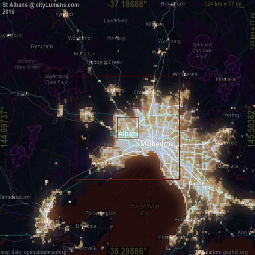
Analysis of St Albans night lights 2016
Square area 10x10 km:
 22.11%
90-99
31.12%80-89
17.01%70-79
18.71%60-69
9.86%50-59
1.19%40-49
0%30-39
0%20-29
0%10-19
0%0-9
0%Square area 50x50 km:
12.86%90-99
10.82%80-89
5.42%70-79
6.41%60-69
4.86%50-59
3.21%40-49
2.8%30-39
3.09%20-29
5.46%10-19
10.49%0-9
34.58%Clear (daylight) street map image can be seen on geolist.org.
Map coordinates:
37° 11' 12.8" South, 144° 5' 50.5" East
37° 44' 41.9" South, 144° 48' 1.8" East
38° 17' 55.9" South, 145° 30' 13" East
Some cities around St Albans sort by population:
• Saint Albans
1.3 km =0.8 mi,  358°
358°
• Deer Park
3.9 km =2.4 mi,  230°
230°
• Sunshine North
3.7 km =2.3 mi,  139°
139°
• Keilor Downs
2.5 km =1.6 mi,  16°
16°
• Cairnlea
1.9 km =1.2 mi,  214°
214°
• Delahey
3.5 km =2.2 mi,  323°
323°
• Kings Park
2.4 km =1.5 mi,  301°
301°
• Albanvale
2.8 km =1.7 mi,  267°
267°
8015209 (p: 37,629)
Sources (retrieved 2019-11-25):
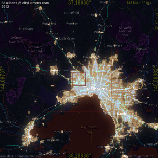
» Earth at Night: Flat Maps 2012, 2016