Avondale Heights night lights from space
Night Light of Avondale Heights (Victoria) from space (Australia) Src. Average luminocity for 10x10km area is 92.1412% and for 50x50km: 49.3241%.
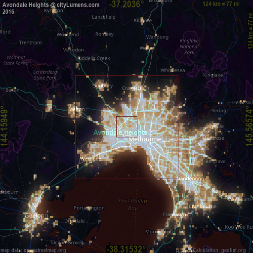
Analysis of Avondale Heights night lights 2016
Square area 10x10 km:
 30.27%
90-99
36.05%80-89
19.05%70-79
12.59%60-69
2.04%50-59
0%40-49
0%30-39
0%20-29
0%10-19
0%0-9
0%Square area 50x50 km:
13.63%90-99
12.24%80-89
6.26%70-79
8.32%60-69
5.84%50-59
4.09%40-49
3.3%30-39
3.42%20-29
5.9%10-19
10.28%0-9
26.72%Clear (daylight) street map image can be seen on geolist.org.
Map coordinates:
37° 12' 13" South, 144° 9' 34.2" East
37° 45' 41.6" South, 144° 51' 45.4" East
38° 18' 55.2" South, 145° 33' 56.7" East
Some cities around Avondale Heights sort by population:
• Keilor East
3.2 km =2 mi,  3°
3°
• Maribyrnong
2.3 km =1.4 mi,  122°
122°
• Sunshine North
3.2 km =2 mi,  253°
253°
• West Footscray
4.2 km =2.6 mi,  162°
162°
• Sunshine
3.5 km =2.2 mi,  226°
226°
• Braybrook
2.9 km =1.8 mi,  193°
193°
• Maidstone
2.3 km =1.4 mi, 155°
• Niddrie
3.7 km =2.3 mi,  44°
44°
8347981 (p: 11,539)
Sources (retrieved 2019-11-25):
» Earth at Night: Flat Maps 2012, 2016