Salisbury Heights night lights from space
Night Light of Salisbury Heights (South Australia) from space (Australia) Src. Average luminocity for 10x10km area is 73.7106% and for 50x50km: 23.9841%.
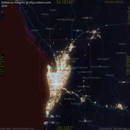
Analysis of Salisbury Heights night lights 2016
Square area 10x10 km:
 15.38%
90-99
19.05%80-89
9.52%70-79
18.32%60-69
12.09%50-59
9.34%40-49
5.49%30-39
3.85%20-29
6.23%10-19
0.73%0-9
0%Square area 50x50 km:
5.47%90-99
5.66%80-89
2.69%70-79
4.42%60-69
3.17%50-59
2.49%40-49
1.78%30-39
1.9%20-29
3.92%10-19
7.72%0-9
60.76%Clear (daylight) street map image can be seen on geolist.org.
Map coordinates:
34° 11' 0.5" South, 137° 58' 22" East
34° 45' 47.2" South, 138° 40' 33.3" East
35° 20' 19.3" South, 139° 22' 44.5" East
Some cities around Salisbury Heights sort by population:
• Parafield Gardens
6.3 km =3.9 mi,  250°
250°
• Paralowie
6.2 km =3.9 mi,  276°
276°
• Golden Grove
5.7 km =3.5 mi,  113°
113°
• Greenwith
3.5 km =2.2 mi,  94°
94°
• Wynn Vale
4.2 km =2.6 mi,  165°
165°
• Modbury Heights
5.3 km =3.3 mi, 170°
• Para Hills
5.7 km =3.5 mi,  196°
196°
• Redwood Park
6.1 km =3.8 mi,  152°
152°
9973265 (p: 5,117)
Sources (retrieved 2019-11-25):
» Earth at Night: Flat Maps 2012, 2016