Para Hills night lights from space
Night Light of Para Hills (South Australia) from space (Australia) Src. Average luminocity for 10x10km area is 86.8846% and for 50x50km: 26.2749%.
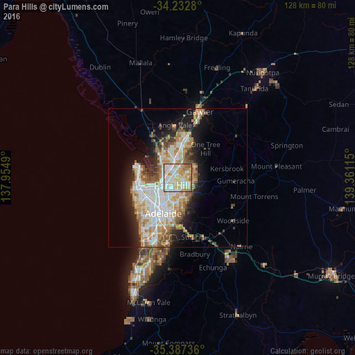
Analysis of Para Hills night lights 2016
Square area 10x10 km:
 23.63%
90-99
29.3%80-89
15.2%70-79
19.23%60-69
8.97%50-59
3.66%40-49
0%30-39
0%20-29
0%10-19
0%0-9
0%Square area 50x50 km:
5.76%90-99
6.13%80-89
2.85%70-79
4.84%60-69
3.78%50-59
2.97%40-49
2.05%30-39
2.04%20-29
4.5%10-19
8.55%0-9
56.51%Clear (daylight) street map image can be seen on geolist.org.
Map coordinates:
34° 13' 58.1" South, 137° 57' 17.6" East
34° 48' 43.6" South, 138° 39' 28.9" East
35° 23' 14.5" South, 139° 21' 40.1" East
Some cities around Para Hills sort by population:
• Salisbury East
2.4 km =1.5 mi,  352°
352°
• Ingle Farm
3.3 km =2.1 mi,  223°
223°
• Wynn Vale
3 km =1.9 mi,  62°
62°
• Pooraka
3.2 km =2 mi,  244°
244°
• Modbury Heights
2.5 km =1.6 mi,  83°
83°
• Valley View
3.1 km =1.9 mi,  175°
175°
• Modbury North
2.3 km =1.4 mi,  141°
141°
• Modbury
3.3 km =2.1 mi, 135°
8348189 (p: 6,468)
Sources (retrieved 2019-11-25):
» Earth at Night: Flat Maps 2012, 2016