Rose Bay night lights from space
Night Light of Rose Bay (New South Wales) from space (Australia) Src. Average luminocity for 10x10km area is 54.7448% and for 50x50km: 34.2604%.
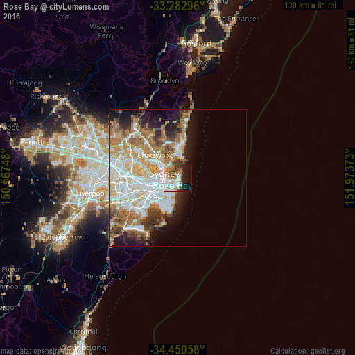
Analysis of Rose Bay night lights 2016
Square area 10x10 km:
 13.11%
90-99
14.16%80-89
3.15%70-79
10.49%60-69
8.04%50-59
5.07%40-49
5.07%30-39
4.72%20-29
10.49%10-19
17.83%0-9
7.87%Square area 50x50 km:
7.92%90-99
8.33%80-89
4.05%70-79
5.32%60-69
7.15%50-59
3.37%40-49
2.09%30-39
3.25%20-29
4%10-19
7.54%0-9
46.97%Clear (daylight) street map image can be seen on geolist.org.
Map coordinates:
33° 16' 58.7" South, 150° 34' 2.9" East
33° 52' 7.6" South, 151° 16' 14.2" East
34° 27' 2.1" South, 151° 58' 25.4" East
Some cities around Rose Bay sort by population:
• Bondi Beach
2.6 km =1.6 mi,  163°
163°
• Bellevue Hill
2.1 km =1.3 mi,  237°
237°
• Bondi
2.9 km =1.8 mi,  191°
191°
• Bondi Junction
3.4 km =2.1 mi,  218°
218°
• Vaucluse
1.6 km =1 mi,  23°
23°
• North Bondi
2.3 km =1.4 mi, 156°
• Woollahra
3.8 km =2.4 mi, 235°
• Bronte
3.7 km =2.3 mi, 187°
2207749 (p: 9,915)
Sources (retrieved 2019-11-25):
» Earth at Night: Flat Maps 2012, 2016