Newman night lights from space
Night Light of Newman (Western Australia) from space (Australia) Src. Average luminocity for 10x10km area is 23.0095% and for 50x50km: 2.79%.
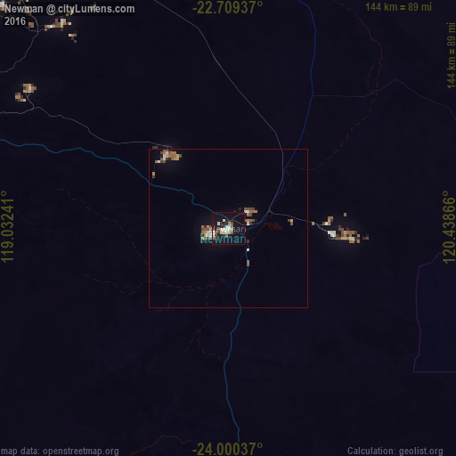
Analysis of Newman night lights 2016
Square area 10x10 km:
 3.98%
3.98%90-99
4.36%80-89
2.27%70-79
0.76%60-69
1.14%50-59
2.65%40-49
3.03%30-39
1.52%20-29
4.73%10-19
34.47%0-9
41.1%Square area 50x50 km:
0.37%90-99
0.35%80-89
0.2%70-79
0.13%60-69
0.5%50-59
0.61%40-49
0.53%30-39
0.22%20-29
0.38%10-19
1.81%0-9
94.9%Clear (daylight) street map image can be seen on geolist.org.
Map coordinates:
22° 42' 33.7" South, 119° 1' 56.7" East
23° 21' 23.2" South, 119° 44' 7.9" East
24° 0' 1.3" South, 120° 26' 19.2" East
Some cities around Newman sort by population:
• Geraldton
790.4 km =491.1 mi,  220°
220°
• Karratha
416.4 km =258.7 mi,  314°
314°
• South Hedland
348.3 km =216.4 mi,  340°
340°
• Cable Beach
652.9 km =405.7 mi,  23°
23°
• Carnarvon
639.7 km =397.5 mi,  254°
254°
• Northam
970.1 km =602.8 mi,  198°
198°
• Port Hedland
357.8 km =222.3 mi, 341°
• Broome
654.5 km =406.7 mi, 23°
2064768 (p: 12,316)
Sources (retrieved 2019-11-25):
» Earth at Night: Flat Maps 2012, 2016