Karratha night lights from space
Night Light of Karratha (Western Australia) from space (Australia) Src. Average luminocity for 10x10km area is 29.6117% and for 50x50km: 4.9785%.
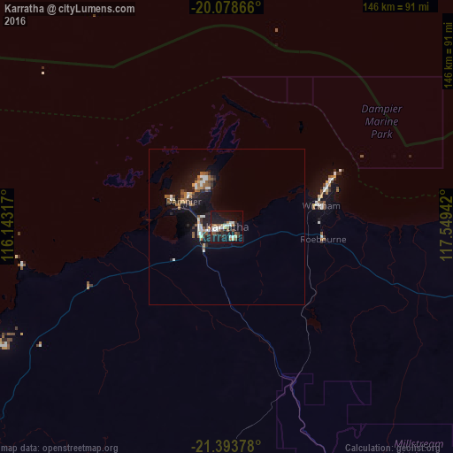
Analysis of Karratha night lights 2016
Square area 10x10 km:
 5.49%
5.49%90-99
5.87%80-89
3.03%70-79
0%60-69
3.79%50-59
6.63%40-49
0.95%30-39
4.17%20-29
3.22%10-19
37.88%0-9
28.98%Square area 50x50 km:
0.65%90-99
0.76%80-89
0.36%70-79
0.22%60-69
0.77%50-59
1.01%40-49
0.31%30-39
0.69%20-29
0.92%10-19
6.39%0-9
87.92%Clear (daylight) street map image can be seen on geolist.org.
Map coordinates:
20° 4' 43.2" South, 116° 8' 35.4" East
20° 44' 15.5" South, 116° 50' 46.6" East
21° 23' 37.6" South, 117° 32' 57.9" East
Some cities around Karratha sort by population:
• Geraldton
922 km =572.9 mi,  194°
194°
• Newman
416.4 km =258.7 mi,  134°
134°
• South Hedland
186.3 km =115.8 mi,  78°
78°
• Yanchep
1207.9 km =750.6 mi, 185°
• Cable Beach
642 km =398.9 mi,  61°
61°
• Carnarvon
565 km =351.1 mi,  215°
215°
• Port Hedland
189.7 km =117.9 mi, 75°
• Broome
644.7 km =400.6 mi, 61°
6620339 (p: 11,728)
Sources (retrieved 2019-11-25):
» Earth at Night: Flat Maps 2012, 2016