Springvale night lights from space
Night Light of Springvale (Victoria) from space (Australia) Src. Average luminocity for 10x10km area is 86.4838% and for 50x50km: 45.7275%.

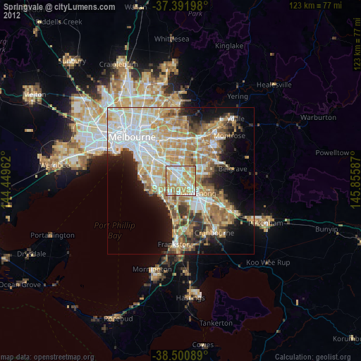
Analysis of Springvale night lights 2016
Square area 10x10 km:
 23.38%
90-99
27.44%80-89
12.5%70-79
24.51%60-69
10.88%50-59
1.3%40-49
0%30-39
0%20-29
0%10-19
0%0-9
0%Square area 50x50 km:
11.26%90-99
10.34%80-89
5.47%70-79
7.59%60-69
7.23%50-59
5.96%40-49
4%30-39
3.79%20-29
5.5%10-19
9.47%0-9
29.39%Clear (daylight) street map image can be seen on geolist.org.
Map coordinates:
37° 23' 31.1" South, 144° 26' 58.6" East
37° 56' 54.7" South, 145° 9' 9.9" East
38° 30' 3.2" South, 145° 51' 21.1" East
Some cities around Springvale sort by population:
• Noble Park
2.4 km =1.5 mi,  148°
148°
• Keysborough
5.1 km =3.2 mi,  158°
158°
• Clayton
4.7 km =2.9 mi,  318°
318°
• Mulgrave
3.1 km =1.9 mi,  43°
43°
• Clayton South
3.6 km =2.2 mi,  298°
298°
• Dingley Village
4.1 km =2.5 mi,  203°
203°
• Clarinda
4.5 km =2.8 mi,  281°
281°
• Noble Park North
3.5 km =2.2 mi,  92°
92°
2148591 (p: 21,572)
Sources (retrieved 2019-11-25):
» Earth at Night: Flat Maps 2012, 2016