Loganlea night lights from space
Night Light of Loganlea (Queensland) from space (Australia) Src. Average luminocity for 10x10km area is 72.0278% and for 50x50km: 35.337%.
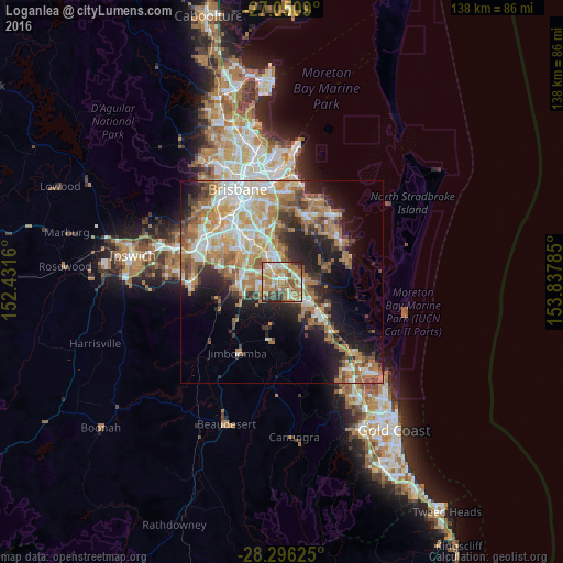
Analysis of Loganlea night lights 2016
Square area 10x10 km:
 13.89%
90-99
12.5%80-89
11.51%70-79
9.13%60-69
31.15%50-59
6.55%40-49
7.54%30-39
3.37%20-29
4.37%10-19
0%0-9
0%Square area 50x50 km:
5.76%90-99
6.59%80-89
4.04%70-79
5.23%60-69
10.84%50-59
3.45%40-49
3.67%30-39
4.09%20-29
6.52%10-19
11.71%0-9
38.1%Clear (daylight) street map image can be seen on geolist.org.
Map coordinates:
27° 3' 3.2" South, 152° 25' 53.8" East
27° 40' 31.3" South, 153° 8' 5" East
28° 17' 46.5" South, 153° 50' 16.3" East
Some cities around Loganlea sort by population:
• Marsden
3.7 km =2.3 mi,  273°
273°
• Crestmead
5.1 km =3.2 mi,  254°
254°
• Shailer Park
5.1 km =3.2 mi,  56°
56°
• Kingston
2 km =1.2 mi,  298°
298°
• Slacks Creek
3.2 km =2 mi,  28°
28°
• Daisy Hill
5.5 km =3.4 mi,  24°
24°
• Waterford West
1.7 km =1.1 mi,  185°
185°
• Edens Landing
4.6 km =2.9 mi,  131°
131°
2159732 (p: 7,296)
Sources (retrieved 2019-11-25):
» Earth at Night: Flat Maps 2012, 2016