Edens Landing night lights from space
Night Light of Edens Landing (Queensland) from space (Australia) Src. Average luminocity for 10x10km area is 60.2103% and for 50x50km: 32.0557%.
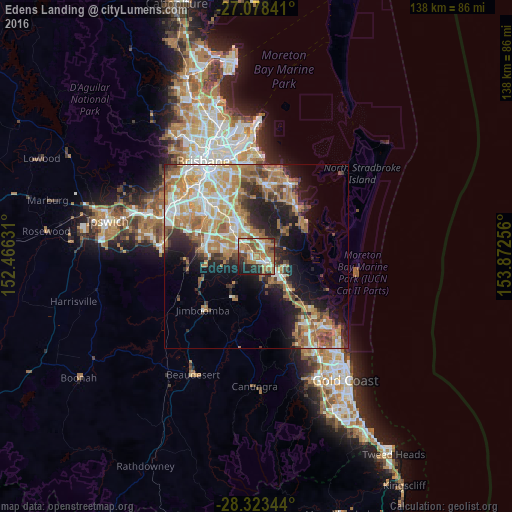
Analysis of Edens Landing night lights 2016
Square area 10x10 km:
 9.52%
9.52%90-99
8.93%80-89
6.94%70-79
4.37%60-69
30.16%50-59
6.75%40-49
7.14%30-39
6.35%20-29
13.29%10-19
6.55%0-9
0%Square area 50x50 km:
4.76%90-99
5.65%80-89
3.73%70-79
4.9%60-69
10.36%50-59
3.13%40-49
3.45%30-39
3.95%20-29
5.99%10-19
11.07%0-9
43.01%Clear (daylight) street map image can be seen on geolist.org.
Map coordinates:
27° 4' 42.3" South, 152° 27' 58.7" East
27° 42' 9.7" South, 153° 10' 9.9" East
28° 19' 24.4" South, 153° 52' 21.2" East
Some cities around Edens Landing sort by population:
• Eagleby
5.1 km =3.2 mi,  65°
65°
• Shailer Park
5.9 km =3.7 mi,  7°
7°
• Beenleigh
3.4 km =2.1 mi,  106°
106°
• Loganlea
4.6 km =2.9 mi,  311°
311°
• Cornubia
6.1 km =3.8 mi,  49°
49°
• Waterford West
3.8 km =2.4 mi,  290°
290°
• Loganholme
2.6 km =1.6 mi,  39°
39°
• Mount Warren Park
4.8 km =3 mi,  131°
131°
8348378 (p: 5,042)
Sources (retrieved 2019-11-25):
» Earth at Night: Flat Maps 2012, 2016