Hoppers Crossing night lights from space
Night Light of Hoppers Crossing (Victoria) from space (Australia) Src. Average luminocity for 10x10km area is 73.263% and for 50x50km: 27.1904%.
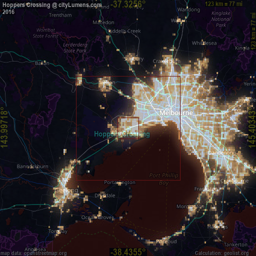
Analysis of Hoppers Crossing night lights 2016
Square area 10x10 km:
 18.34%
90-99
18.34%80-89
9.74%70-79
11.04%60-69
17.21%50-59
6.66%40-49
3.9%30-39
5.68%20-29
9.09%10-19
0%0-9
0%Square area 50x50 km:
8.45%90-99
6.52%80-89
3.13%70-79
3.47%60-69
2.8%50-59
2.27%40-49
1.86%30-39
2.06%20-29
3.78%10-19
6.95%0-9
58.73%Clear (daylight) street map image can be seen on geolist.org.
Map coordinates:
37° 19' 32.2" South, 143° 59' 49.8" East
37° 52' 57.5" South, 144° 42' 1.1" East
38° 26' 7.8" South, 145° 24' 12.3" East
Some cities around Hoppers Crossing sort by population:
• Point Cook
5.7 km =3.5 mi,  128°
128°
• Werribee
3.5 km =2.2 mi,  236°
236°
• Tarneit
6.3 km =3.9 mi,  325°
325°
• Wyndham Vale
6.8 km =4.2 mi,  261°
261°
• Altona Meadows
7.3 km =4.5 mi,  91°
91°
• Williams Landing
4.5 km =2.8 mi,  58°
58°
• Seabrook
5.1 km =3.2 mi, 87°
• Laverton
6.5 km =4 mi,  69°
69°
7281807 (p: 38,178)
Sources (retrieved 2019-11-25):
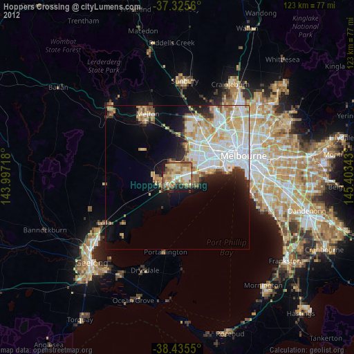
» Earth at Night: Flat Maps 2012, 2016