Point Cook night lights from space
Night Light of Point Cook (Victoria) from space (Australia) Src. Average luminocity for 10x10km area is 44.9042% and for 50x50km: 29.0822%.
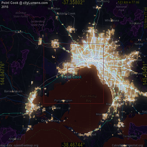
Analysis of Point Cook night lights 2016
Square area 10x10 km:
 8.44%
8.44%90-99
9.25%80-89
4.87%70-79
6.49%60-69
7.31%50-59
6.82%40-49
3.25%30-39
6.66%20-29
11.36%10-19
19.81%0-9
15.75%Square area 50x50 km:
9.96%90-99
7.41%80-89
3.54%70-79
3.73%60-69
2.4%50-59
1.94%40-49
1.5%30-39
1.76%20-29
3.4%10-19
6.26%0-9
58.1%Clear (daylight) street map image can be seen on geolist.org.
Map coordinates:
37° 21' 28.9" South, 144° 2' 51.9" East
37° 54' 53.4" South, 144° 45' 3.2" East
38° 28' 2.8" South, 145° 27' 14.4" East
Some cities around Point Cook sort by population:
• Werribee
7.6 km =4.7 mi,  282°
282°
• Hoppers Crossing
5.7 km =3.5 mi,  308°
308°
• Truganina
10.9 km =6.8 mi,  359°
359°
• Altona Meadows
4.5 km =2.8 mi,  40°
40°
• Altona
8.6 km =5.3 mi,  54°
54°
• Williams Landing
5.9 km =3.7 mi,  353°
353°
• Seabrook
3.8 km =2.4 mi,  10°
10°
• Laverton
6.1 km =3.8 mi,  15°
15°
2152819 (p: 49,436)
Sources (retrieved 2019-11-25):
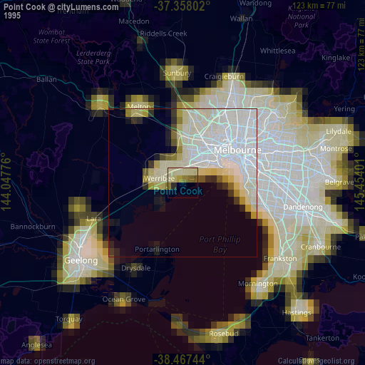
» NASA, Earths city lights 1995
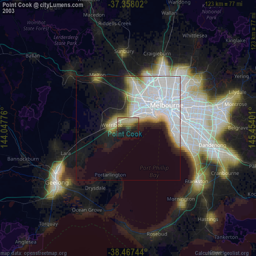
» NASA city lights 2003
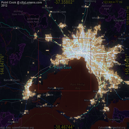
» Earth at Night: Flat Maps 2012, 2016