Hocking night lights from space
Night Light of Hocking (Western Australia) from space (Australia) Src. Average luminocity for 10x10km area is 65.4414% and for 50x50km: 29.7604%.
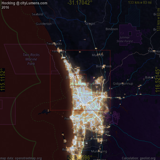
Analysis of Hocking night lights 2016
Square area 10x10 km:
 15.93%
90-99
13.74%80-89
4.58%70-79
13.55%60-69
13.92%50-59
9.34%40-49
6.78%30-39
4.95%20-29
8.79%10-19
6.96%0-9
1.47%Square area 50x50 km:
7.13%90-99
7.33%80-89
2.75%70-79
3.73%60-69
5.49%50-59
3.14%40-49
2.03%30-39
3.2%20-29
5.24%10-19
8.7%0-9
51.25%Clear (daylight) street map image can be seen on geolist.org.
Map coordinates:
31° 10' 13.5" South, 115° 6' 54.7" East
31° 46' 12.4" South, 115° 49' 6" East
32° 21' 57.5" South, 116° 31' 17.2" East
Some cities around Hocking sort by population:
• Kingsley
4.8 km =3 mi,  200°
200°
• Wanneroo
2.8 km =1.7 mi,  322°
322°
• Joondalup
5.5 km =3.4 mi,  301°
301°
• Woodvale
2.9 km =1.8 mi,  223°
223°
• Darch
5.4 km =3.4 mi,  151°
151°
• Heathridge
5.7 km =3.5 mi,  278°
278°
• Madeley
4.7 km =2.9 mi,  168°
168°
• Craigie
5 km =3.1 mi,  247°
247°
8347709 (p: 5,783)
Sources (retrieved 2019-11-25):
» Earth at Night: Flat Maps 2012, 2016