Kingsley night lights from space
Night Light of Kingsley (Western Australia) from space (Australia) Src. Average luminocity for 10x10km area is 83.0311% and for 50x50km: 33.1135%.
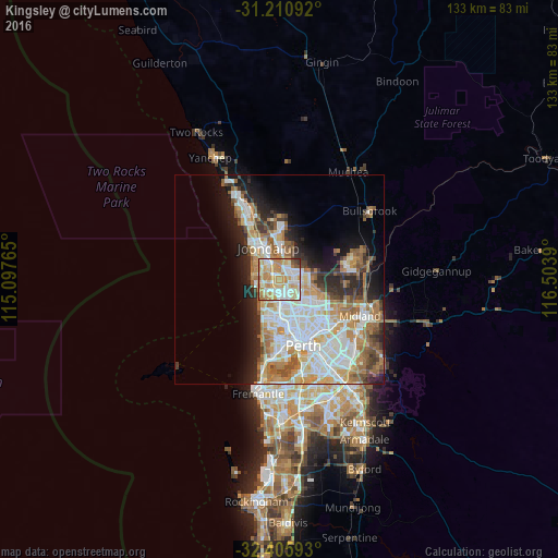
Analysis of Kingsley night lights 2016
Square area 10x10 km:
 18.86%
90-99
22.53%80-89
14.65%70-79
25.46%60-69
12.82%50-59
2.2%40-49
2.01%30-39
1.28%20-29
0.18%10-19
0%0-9
0%Square area 50x50 km:
7.76%90-99
8.16%80-89
3.33%70-79
4.71%60-69
6.24%50-59
3.56%40-49
2.4%30-39
3.14%20-29
5.45%10-19
7.91%0-9
47.35%Clear (daylight) street map image can be seen on geolist.org.
Map coordinates:
31° 12' 39.3" South, 115° 5' 51.5" East
31° 48' 37.3" South, 115° 48' 2.8" East
32° 24' 21.3" South, 116° 30' 14" East
Some cities around Kingsley sort by population:
• Duncraig
3.4 km =2.1 mi,  223°
223°
• Marangaroo
4 km =2.5 mi,  117°
117°
• Greenwood
1.9 km =1.2 mi,  175°
175°
• Woodvale
2.4 km =1.5 mi,  350°
350°
• Padbury
3.1 km =1.9 mi,  278°
278°
• Darch
4.3 km =2.7 mi,  93°
93°
• Madeley
2.6 km =1.6 mi, 91°
• Craigie
3.9 km =2.4 mi,  311°
311°
8349069 (p: 12,812)
Sources (retrieved 2019-11-25):
» Earth at Night: Flat Maps 2012, 2016