Gymea Bay night lights from space
Night Light of Gymea Bay (New South Wales) from space (Australia) Src. Average luminocity for 10x10km area is 44.9528% and for 50x50km: 33.5078%.
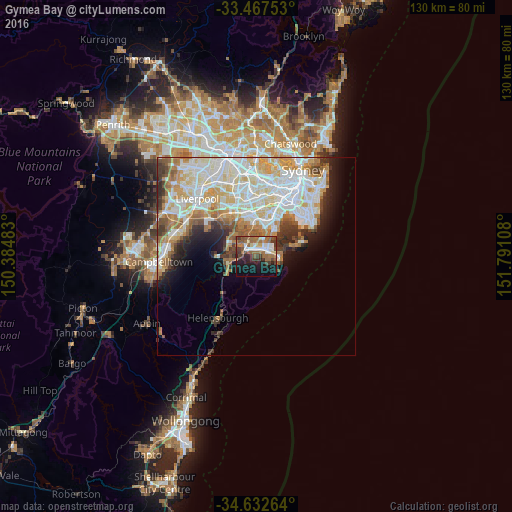
Analysis of Gymea Bay night lights 2016
Square area 10x10 km:
 7.52%
7.52%90-99
5.77%80-89
3.67%70-79
1.92%60-69
16.08%50-59
9.79%40-49
6.47%30-39
8.74%20-29
7.87%10-19
22.9%0-9
9.27%Square area 50x50 km:
9.1%90-99
9.14%80-89
4.37%70-79
4.37%60-69
4.35%50-59
3.12%40-49
2.07%30-39
3.13%20-29
3.48%10-19
5.61%0-9
51.26%Clear (daylight) street map image can be seen on geolist.org.
Map coordinates:
33° 28' 3.1" South, 150° 23' 5.4" East
34° 3' 7.5" South, 151° 5' 16.6" East
34° 37' 57.5" South, 151° 47' 27.9" East
Some cities around Gymea Bay sort by population:
• Miranda
1.9 km =1.2 mi,  36°
36°
• Caringbah South
3.1 km =1.9 mi,  99°
99°
• Caringbah
3.9 km =2.4 mi,  61°
61°
• Sutherland
3.8 km =2.4 mi,  307°
307°
• Sylvania
4.5 km =2.8 mi,  10°
10°
• Kirrawee
2.3 km =1.4 mi, 311°
• Jannali
4.7 km =2.9 mi,  327°
327°
• Oyster Bay
5.5 km =3.4 mi,  348°
348°
2205979 (p: 6,725)
Sources (retrieved 2019-11-25):
» Earth at Night: Flat Maps 2012, 2016