Jannali night lights from space
Night Light of Jannali (New South Wales) from space (Australia) Src. Average luminocity for 10x10km area is 61.1014% and for 50x50km: 40.8602%.
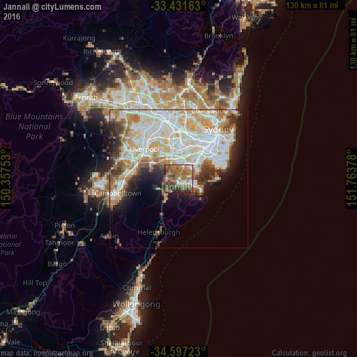
Analysis of Jannali night lights 2016
Square area 10x10 km:
 6.47%
6.47%90-99
7.52%80-89
2.62%70-79
6.82%60-69
28.67%50-59
22.2%40-49
9.62%30-39
10.31%20-29
5.42%10-19
0.35%0-9
0%Square area 50x50 km:
10.96%90-99
11.12%80-89
5.39%70-79
5.59%60-69
5.59%50-59
3.63%40-49
2.51%30-39
3.87%20-29
4.25%10-19
6.23%0-9
40.86%Clear (daylight) street map image can be seen on geolist.org.
Map coordinates:
33° 25' 53.9" South, 150° 21' 27.1" East
34° 0' 59.1" South, 151° 3' 38.3" East
34° 35' 50" South, 151° 45' 49.6" East
Some cities around Jannali sort by population:
• Sutherland
1.7 km =1.1 mi,  196°
196°
• Sylvania
3.4 km =2.1 mi,  82°
82°
• Menai
4.1 km =2.5 mi,  269°
269°
• Kirrawee
2.6 km =1.6 mi,  162°
162°
• Gymea
3.2 km =2 mi,  134°
134°
• Illawong
3.1 km =1.9 mi,  305°
305°
• Bangor
2.5 km =1.6 mi, 269°
• Oyster Bay
2 km =1.2 mi,  45°
45°
2162419 (p: 6,078)
Sources (retrieved 2019-11-25):
» Earth at Night: Flat Maps 2012, 2016