Sylvania night lights from space
Night Light of Sylvania (New South Wales) from space (Australia) Src. Average luminocity for 10x10km area is 69.3584% and for 50x50km: 38.8321%.
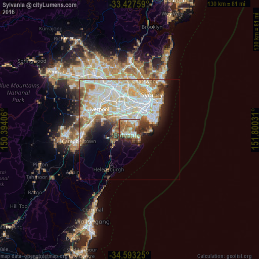
Analysis of Sylvania night lights 2016
Square area 10x10 km:
 13.64%
90-99
13.99%80-89
4.02%70-79
10.31%60-69
25%50-59
16.61%40-49
4.55%30-39
8.04%20-29
3.85%10-19
0%0-9
0%Square area 50x50 km:
10.76%90-99
11.06%80-89
5.31%70-79
5.41%60-69
4.82%50-59
3.28%40-49
2.06%30-39
2.74%20-29
3.4%10-19
5.73%0-9
45.41%Clear (daylight) street map image can be seen on geolist.org.
Map coordinates:
33° 25' 39.3" South, 150° 23' 38.6" East
34° 0' 44.7" South, 151° 5' 49.8" East
34° 35' 35.7" South, 151° 48' 1.1" East
Some cities around Sylvania sort by population:
• Miranda
2.9 km =1.8 mi,  174°
174°
• Caringbah
3.6 km =2.2 mi,  135°
135°
• Kirrawee
3.9 km =2.4 mi,  222°
222°
• Gymea
2.9 km =1.8 mi,  202°
202°
• Blakehurst
2.6 km =1.6 mi,  24°
24°
• Jannali
3.4 km =2.1 mi,  262°
262°
• Oyster Bay
2.2 km =1.4 mi,  295°
295°
• South Hurstville
4 km =2.5 mi,  11°
11°
2205984 (p: 10,422)
Sources (retrieved 2019-11-25):
» Earth at Night: Flat Maps 2012, 2016