Oyster Bay night lights from space
Night Light of Oyster Bay (New South Wales) from space (Australia) Src. Average luminocity for 10x10km area is 70.4913% and for 50x50km: 42.1176%.
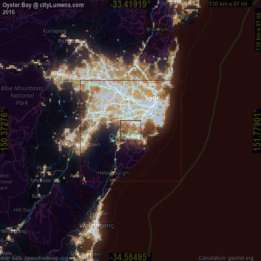
Analysis of Oyster Bay night lights 2016
Square area 10x10 km:
 12.41%
90-99
14.34%80-89
3.85%70-79
8.39%60-69
29.55%50-59
19.76%40-49
6.99%30-39
3.67%20-29
1.05%10-19
0%0-9
0%Square area 50x50 km:
11.23%90-99
11.69%80-89
5.79%70-79
6.15%60-69
5.6%50-59
3.54%40-49
2.37%30-39
3.53%20-29
3.99%10-19
6.05%0-9
40.06%Clear (daylight) street map image can be seen on geolist.org.
Map coordinates:
33° 25' 9.1" South, 150° 22' 21.9" East
34° 0' 14.7" South, 151° 4' 33.2" East
34° 35' 5.8" South, 151° 46' 44.4" East
Some cities around Oyster Bay sort by population:
• Sutherland
3.5 km =2.2 mi,  212°
212°
• Sylvania
2.2 km =1.4 mi,  115°
115°
• Oatley
2.7 km =1.7 mi,  352°
352°
• Kirrawee
3.9 km =2.4 mi,  189°
189°
• Gymea
3.7 km =2.3 mi,  166°
166°
• Illawong
3.9 km =2.4 mi,  276°
276°
• Blakehurst
3.3 km =2.1 mi,  65°
65°
• Jannali
2 km =1.2 mi,  225°
225°
2205988 (p: 5,379)
Sources (retrieved 2019-11-25):
» Earth at Night: Flat Maps 2012, 2016