Gladstone night lights from space
Night Light of Gladstone (Queensland) from space (Australia) Src. Average luminocity for 10x10km area is 66.0913% and for 50x50km: 8.2317%.
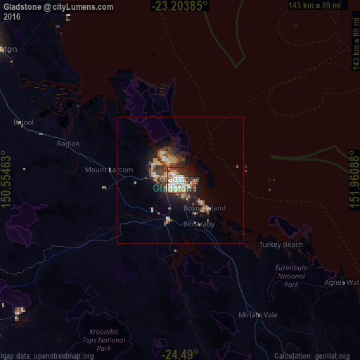
Analysis of Gladstone night lights 2016
Square area 10x10 km:
 17.86%
90-99
16.27%80-89
10.91%70-79
9.72%60-69
6.15%50-59
4.37%40-49
5.56%30-39
8.33%20-29
12.5%10-19
7.74%0-9
0.6%Square area 50x50 km:
0.95%90-99
1%80-89
1.35%70-79
1.2%60-69
0.79%50-59
1.03%40-49
1.97%30-39
1.59%20-29
2.05%10-19
5.1%0-9
82.95%Clear (daylight) street map image can be seen on geolist.org.
Map coordinates:
23° 12' 13.9" South, 150° 33' 16.7" East
23° 50' 54.7" South, 151° 15' 27.9" East
24° 29' 24" South, 151° 57' 39.2" East
Some cities around Gladstone sort by population:
• Rockhampton
92.6 km =57.5 mi,  304°
304°
• Frenchville
91.6 km =56.9 mi,  307°
307°
• Berserker
92.8 km =57.7 mi, 305°
• Clinton
5 km =3.1 mi,  233°
233°
• The Range
92.7 km =57.6 mi, 303°
• Tannum Sands
15.7 km =9.8 mi,  134°
134°
• Calliope
18.6 km =11.6 mi,  198°
198°
• Park Avenue
93.3 km =58 mi, 306°
2165478 (p: 30,489)
Sources (retrieved 2019-11-25):
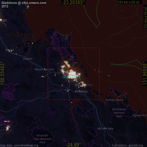
» Earth at Night: Flat Maps 2012, 2016