Calliope night lights from space
Night Light of Calliope (Queensland) from space (Australia) Src. Average luminocity for 10x10km area is 6.3617% and for 50x50km: 7.0371%.
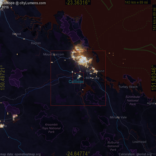
Analysis of Calliope night lights 2016
Square area 10x10 km:
 0.38%
0.38%90-99
0.38%80-89
0.76%70-79
2.46%60-69
0.76%50-59
0.76%40-49
1.14%30-39
0.76%20-29
0.38%10-19
0%0-9
92.23%Square area 50x50 km:
0.87%90-99
0.9%80-89
1.18%70-79
1.03%60-69
0.73%50-59
0.81%40-49
1.72%30-39
1.19%20-29
1.79%10-19
3.99%0-9
85.78%Clear (daylight) street map image can be seen on geolist.org.
Map coordinates:
23° 21' 47.4" South, 150° 29' 50" East
24° 0' 25.4" South, 151° 12' 1.2" East
24° 38' 51.9" South, 151° 54' 12.5" East
Some cities around Calliope sort by population:
• Rockhampton
99.3 km =61.7 mi,  314°
314°
• Gladstone
18.6 km =11.6 mi,  18°
18°
• Gracemere
98.6 km =61.3 mi, 309°
• Frenchville
99.2 km =61.6 mi,  317°
317°
• Biloela
81.9 km =50.9 mi,  238°
238°
• Clinton
14.8 km =9.2 mi,  6°
6°
• The Range
99.1 km =61.6 mi, 313°
• Tannum Sands
18.2 km =11.3 mi,  68°
68°
2172728 (p: 5,060)
Sources (retrieved 2019-11-25):
» Earth at Night: Flat Maps 2012, 2016