Evatt night lights from space
Night Light of Evatt (ACT) from space (Australia) Src. Average luminocity for 10x10km area is 71.2885% and for 50x50km: 15.0405%.
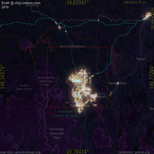
Analysis of Evatt night lights 2016
Square area 10x10 km:
100  13.29%
90-99 14.69%
80-89 13.29%
70-79 15.91%
60-69 20.63%
50-59 4.02%
40-49 3.32%
30-39 4.2%
20-29 6.82%
10-19 3.85%
0-9 0%
13.29%90-99
14.69%80-89
13.29%70-79
15.91%60-69
20.63%50-59
4.02%40-49
3.32%30-39
4.2%20-29
6.82%10-19
3.85%0-9
0%Square area 50x50 km:
100 2.41%
90-99 2.96%
80-89 1.46%
70-79 2.28%
60-69 3.67%
50-59 1.8%
40-49 1.31%
30-39 2.49%
20-29 3.15%
10-19 5.96%
0-9 72.51%
2.41%90-99
2.96%80-89
1.46%70-79
2.28%60-69
3.67%50-59
1.8%40-49
1.31%30-39
2.49%20-29
3.15%10-19
5.96%0-9
72.51%Clear (daylight) street map image can be seen on geolist.org.
Map coordinates:
34° 38' 7.5" South, 148° 21' 56.8" East
35° 12' 42.9" South, 149° 4' 8.1" East
35° 47' 3.6" South, 149° 46' 19.3" East
Some cities around Evatt sort by population:
• Bruce
4.1 km =2.5 mi,  150°
150°
• Kaleen
3.4 km =2.1 mi,  101°
101°
• Dunlop
4.9 km =3 mi,  294°
294°
• Nicholls
3.7 km =2.3 mi,  42°
42°
• Macgregor
5.3 km =3.3 mi,  272°
272°
• Belconnen
2.9 km =1.8 mi,  184°
184°
• Casey
5.5 km =3.4 mi,  25°
25°
• Palmerston
5 km =3.1 mi,  67°
67°
8349175 (p: 5,187)
Sources (retrieved 2019-11-25):
» Earth at Night: Flat Maps 2012, 2016