Doreen night lights from space
Night Light of Doreen (Victoria) from space (Australia) Src. Average luminocity for 10x10km area is 20.0255% and for 50x50km: 26.2071%.
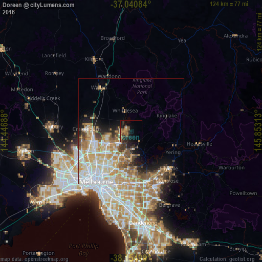

Analysis of Doreen night lights 2016
Square area 10x10 km:
 0.17%
0.17%90-99
2.38%80-89
0.17%70-79
5.1%60-69
4.08%50-59
5.27%40-49
4.42%30-39
1.02%20-29
8.16%10-19
16.16%0-9
53.06%Square area 50x50 km:
6.01%90-99
5.75%80-89
3.58%70-79
4.81%60-69
3.89%50-59
3.1%40-49
2.72%30-39
2.19%20-29
2.91%10-19
5.04%0-9
60.01%Clear (daylight) street map image can be seen on geolist.org.
Map coordinates:
37° 2' 27" South, 144° 26' 48.8" East
37° 36' 0" South, 145° 9' 0" East
38° 9' 18" South, 145° 51' 11.3" East
Some cities around Doreen sort by population:
• Epping
11.7 km =7.3 mi,  241°
241°
• Mill Park
10.4 km =6.5 mi,  224°
224°
• South Morang
7.1 km =4.4 mi, 218°
• Mernda
4.8 km =3 mi,  269°
269°
• Diamond Creek
7.4 km =4.6 mi,  180°
180°
• Wollert
10.4 km =6.5 mi,  280°
280°
• Eltham North
11.1 km =6.9 mi, 180°
• Whittlesea
10.2 km =6.3 mi,  344°
344°
2168537 (p: 20,954)
Sources (retrieved 2019-11-25):
» Earth at Night: Flat Maps 2012, 2016