Wollert night lights from space
Night Light of Wollert (Victoria) from space (Australia) Src. Average luminocity for 10x10km area is 24.3537% and for 50x50km: 28.4239%.
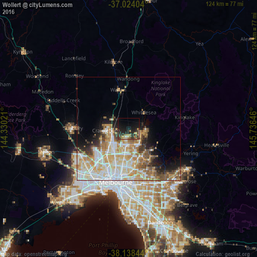
Analysis of Wollert night lights 2016
Square area 10x10 km:
 0.51%
0.51%90-99
2.72%80-89
1.19%70-79
7.14%60-69
1.36%50-59
2.21%40-49
5.61%30-39
6.63%20-29
14.8%10-19
22.79%0-9
35.03%Square area 50x50 km:
6.29%90-99
6.84%80-89
4.1%70-79
5.12%60-69
4.06%50-59
2.83%40-49
2.8%30-39
2.14%20-29
3.44%10-19
5.46%0-9
56.93%Clear (daylight) street map image can be seen on geolist.org.
Map coordinates:
37° 1' 26.5" South, 144° 19' 48.8" East
37° 34' 60" South, 145° 1' 60" East
38° 8' 18.4" South, 145° 44' 11.3" East
Some cities around Wollert sort by population:
• Craigieburn
7.6 km =4.7 mi,  255°
255°
• Epping
7.4 km =4.6 mi,  180°
180°
• Mill Park
9.7 km =6 mi,  162°
162°
• South Morang
9.5 km =5.9 mi,  141°
141°
• Lalor
9.4 km =5.8 mi,  188°
188°
• Roxburgh Park
10.6 km =6.6 mi,  243°
243°
• Doreen
10.4 km =6.5 mi,  100°
100°
• Mernda
5.8 km =3.6 mi,  109°
109°
2143255 (p: 9,053)
Sources (retrieved 2019-11-25):
» Earth at Night: Flat Maps 2012, 2016