Eltham North night lights from space
Night Light of Eltham North (Victoria) from space (Australia) Src. Average luminocity for 10x10km area is 38.3554% and for 50x50km: 39.5793%.
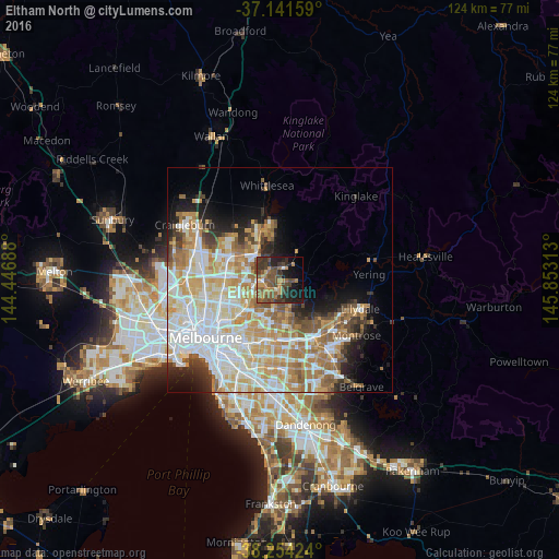
Analysis of Eltham North night lights 2016
Square area 10x10 km:
 0.85%
0.85%90-99
1.36%80-89
1.87%70-79
9.69%60-69
7.14%50-59
12.41%40-49
15.82%30-39
10.88%20-29
10.03%10-19
16.16%0-9
13.78%Square area 50x50 km:
10.29%90-99
9.06%80-89
5.09%70-79
6.95%60-69
5.99%50-59
4.27%40-49
3.26%30-39
2.85%20-29
4.08%10-19
6.51%0-9
41.64%Clear (daylight) street map image can be seen on geolist.org.
Map coordinates:
37° 8' 29.7" South, 144° 26' 48.8" East
37° 42' 0" South, 145° 9' 0" East
38° 15' 15.3" South, 145° 51' 11.3" East
Some cities around Eltham North sort by population:
• Bundoora
7.9 km =4.9 mi,  271°
271°
• South Morang
7.1 km =4.4 mi,  321°
321°
• Greensborough
4.2 km =2.6 mi,  262°
262°
• Templestowe
6 km =3.7 mi,  181°
181°
• Diamond Creek
3.7 km =2.3 mi,  0°
0°
• Montmorency
3.5 km =2.2 mi,  237°
237°
• Viewbank
6.7 km =4.2 mi,  228°
228°
• Watsonia
6.2 km =3.9 mi,  252°
252°
2167444 (p: 6,712)
Sources (retrieved 2019-11-25):
» Earth at Night: Flat Maps 2012, 2016