Donvale night lights from space
Night Light of Donvale (Victoria) from space (Australia) Src. Average luminocity for 10x10km area is 64.1871% and for 50x50km: 45.122%.
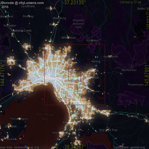
Analysis of Donvale night lights 2016
Square area 10x10 km:
 8.33%
8.33%90-99
11.9%80-89
8.16%70-79
10.71%60-69
18.71%50-59
16.33%40-49
11.39%30-39
2.21%20-29
8.5%10-19
3.74%0-9
0%Square area 50x50 km:
11.23%90-99
10.42%80-89
5.59%70-79
8.63%60-69
7.33%50-59
5.09%40-49
3.42%30-39
2.85%20-29
4.87%10-19
7.18%0-9
33.39%Clear (daylight) street map image can be seen on geolist.org.
Map coordinates:
37° 13' 52.9" South, 144° 28' 18.3" East
37° 47' 20.8" South, 145° 10' 29.6" East
38° 20' 33.6" South, 145° 52' 40.8" East
Some cities around Donvale sort by population:
• Doncaster East
2.3 km =1.4 mi,  274°
274°
• Doncaster
4.5 km =2.8 mi, 271°
• Templestowe
4.5 km =2.8 mi,  329°
329°
• Mitcham
3.8 km =2.4 mi,  144°
144°
• Blackburn
3.8 km =2.4 mi,  209°
209°
• Box Hill North
4.5 km =2.8 mi,  250°
250°
• Nunawading
3.5 km =2.2 mi,  182°
182°
• Blackburn North
3 km =1.9 mi,  222°
222°
2168579 (p: 12,076)
Sources (retrieved 2019-11-25):
» Earth at Night: Flat Maps 2012, 2016