Box Hill North night lights from space
Night Light of Box Hill North (Victoria) from space (Australia) Src. Average luminocity for 10x10km area is 77.6888% and for 50x50km: 49.8792%.
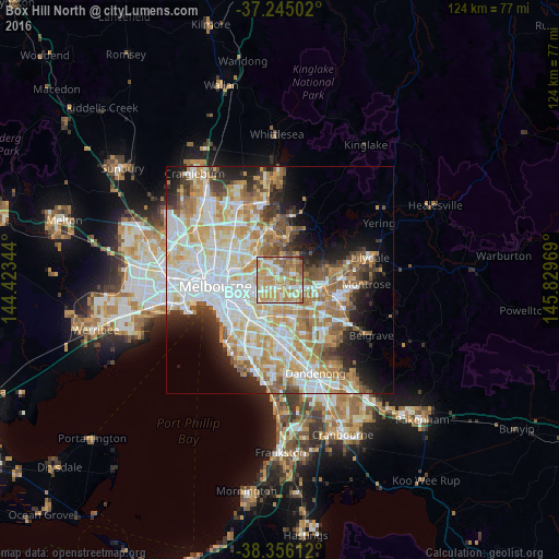
Analysis of Box Hill North night lights 2016
Square area 10x10 km:
 7.82%
7.82%90-99
19.22%80-89
17.01%70-79
24.32%60-69
20.24%50-59
9.69%40-49
1.36%30-39
0%20-29
0.34%10-19
0%0-9
0%Square area 50x50 km:
12.84%90-99
12.05%80-89
6.15%70-79
8.97%60-69
7.57%50-59
5.34%40-49
3.81%30-39
3.26%20-29
5.55%10-19
7.71%0-9
26.76%Clear (daylight) street map image can be seen on geolist.org.
Map coordinates:
37° 14' 42.1" South, 144° 25' 24.4" East
37° 48' 9.6" South, 145° 7' 35.6" East
38° 21' 22" South, 145° 49' 46.9" East
Some cities around Box Hill North sort by population:
• Doncaster East
2.6 km =1.6 mi,  49°
49°
• Doncaster
1.6 km =1 mi,  351°
351°
• Balwyn North
3.2 km =2 mi,  294°
294°
• Blackburn
3 km =1.9 mi,  127°
127°
• Surrey Hills
2.8 km =1.7 mi,  236°
236°
• Templestowe Lower
4.1 km =2.5 mi, 347°
• Blackburn North
2.3 km =1.4 mi,  108°
108°
• Mont Albert North
1.6 km =1 mi,  278°
278°
7932631 (p: 11,703)
Sources (retrieved 2019-11-25):
» Earth at Night: Flat Maps 2012, 2016