Bundoora night lights from space
Night Light of Bundoora (Victoria) from space (Australia) Src. Average luminocity for 10x10km area is 76.3571% and for 50x50km: 45.8745%.
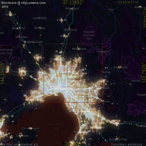
Analysis of Bundoora night lights 2016
Square area 10x10 km:
 12.59%
90-99
21.26%80-89
11.9%70-79
19.05%60-69
17.35%50-59
6.97%40-49
4.08%30-39
6.63%20-29
0.17%10-19
0%0-9
0%Square area 50x50 km:
12.54%90-99
11.07%80-89
5.77%70-79
7.66%60-69
6.58%50-59
4.43%40-49
3.53%30-39
3.23%20-29
5.06%10-19
7.06%0-9
33.09%Clear (daylight) street map image can be seen on geolist.org.
Map coordinates:
37° 8' 23.4" South, 144° 21' 23.6" East
37° 41' 53.7" South, 145° 3' 34.8" East
38° 15' 9" South, 145° 45' 46.1" East
Some cities around Bundoora sort by population:
• Mill Park
3.6 km =2.2 mi,  9°
9°
• Thomastown
4.1 km =2.5 mi,  293°
293°
• Greensborough
3.9 km =2.4 mi,  100°
100°
• Macleod
3.9 km =2.4 mi,  171°
171°
• Rosanna
4.6 km =2.9 mi, 171°
• Heidelberg Heights
5 km =3.1 mi,  182°
182°
• Heidelberg West
4.9 km =3 mi,  200°
200°
• Watsonia
2.9 km =1.8 mi,  134°
134°
8349381 (p: 28,828)
Sources (retrieved 2019-11-25):
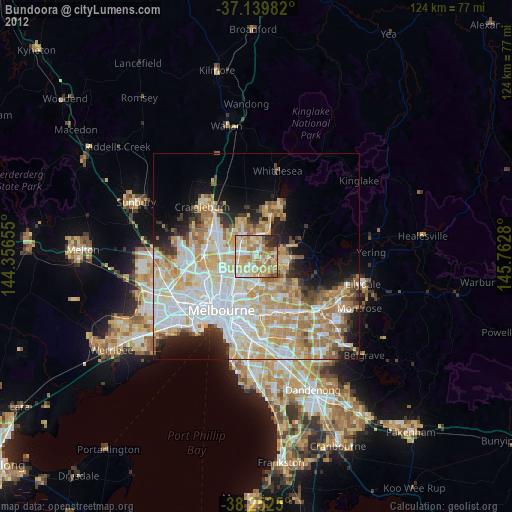
» Earth at Night: Flat Maps 2012, 2016