Greensborough night lights from space
Night Light of Greensborough (Victoria) from space (Australia) Src. Average luminocity for 10x10km area is 62.4473% and for 50x50km: 43.72%.
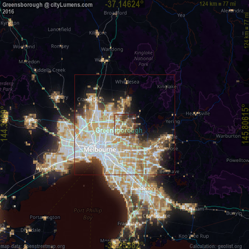
Analysis of Greensborough night lights 2016
Square area 10x10 km:
 5.95%
5.95%90-99
10.03%80-89
5.95%70-79
16.33%60-69
16.67%50-59
14.63%40-49
14.29%30-39
10.54%20-29
3.91%10-19
1.7%0-9
0%Square area 50x50 km:
11.65%90-99
10.4%80-89
5.44%70-79
7.5%60-69
6.37%50-59
4.36%40-49
3.46%30-39
3.15%20-29
4.73%10-19
7.3%0-9
35.64%Clear (daylight) street map image can be seen on geolist.org.
Map coordinates:
37° 8' 46.5" South, 144° 23' 59.6" East
37° 42' 16.6" South, 145° 6' 10.9" East
38° 15' 31.8" South, 145° 48' 22.1" East
Some cities around Greensborough sort by population:
• Bundoora
3.9 km =2.4 mi,  280°
280°
• Eltham
5.2 km =3.2 mi,  127°
127°
• Macleod
4.5 km =2.8 mi,  225°
225°
• Montmorency
1.8 km =1.1 mi,  138°
138°
• Rosanna
4.9 km =3 mi,  219°
219°
• Viewbank
4 km =2.5 mi,  192°
192°
• Eltham North
4.2 km =2.6 mi,  82°
82°
• Watsonia
2.2 km =1.4 mi, 232°
2164515 (p: 20,407)
Sources (retrieved 2019-11-25):
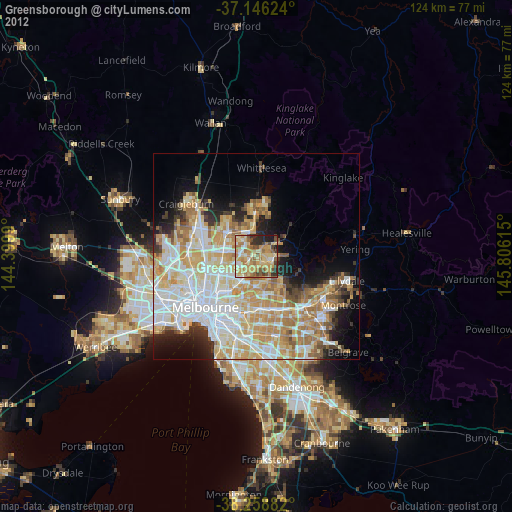
» Earth at Night: Flat Maps 2012, 2016