Bayswater night lights from space
Night Light of Bayswater (Victoria) from space (Australia) Src. Average luminocity for 10x10km area is 70.6347% and for 50x50km: 39.4591%.
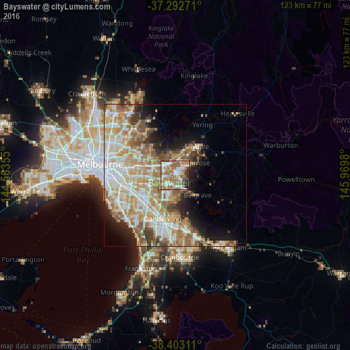
Analysis of Bayswater night lights 2016
Square area 10x10 km:
 14.12%
90-99
15.1%80-89
5.36%70-79
9.9%60-69
26.3%50-59
15.26%40-49
4.87%30-39
2.11%20-29
6.17%10-19
0.81%0-9
0%Square area 50x50 km:
8.07%90-99
9.03%80-89
4.76%70-79
7.84%60-69
7.48%50-59
5.6%40-49
3.58%30-39
2.68%20-29
3.91%10-19
6.97%0-9
40.07%Clear (daylight) street map image can be seen on geolist.org.
Map coordinates:
37° 17' 33.8" South, 144° 33' 48.8" East
37° 51' 0" South, 145° 16' 0" East
38° 24' 11.2" South, 145° 58' 11.3" East
Some cities around Bayswater sort by population:
• Croydon
5.7 km =3.5 mi,  14°
14°
• Ferntree Gully
4.6 km =2.9 mi,  146°
146°
• Boronia
2.4 km =1.5 mi,  141°
141°
• Ringwood
4.7 km =2.9 mi,  321°
321°
• Wantirna
4.4 km =2.7 mi,  270°
270°
• Ringwood East
4 km =2.5 mi,  338°
338°
• Heathmont
2.4 km =1.5 mi, 321°
• Knoxfield
4.7 km =2.9 mi,  198°
198°
2176566 (p: 11,599)
Sources (retrieved 2019-11-25):
» Earth at Night: Flat Maps 2012, 2016