Baldivis night lights from space
Night Light of Baldivis (Western Australia) from space (Australia) Src. Average luminocity for 10x10km area is 36.3132% and for 50x50km: 17.4713%.
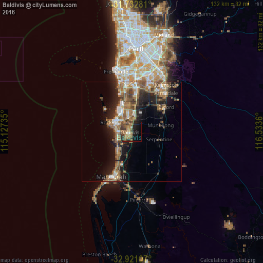

Analysis of Baldivis night lights 2016
Square area 10x10 km:
 1.47%
1.47%90-99
2.38%80-89
4.95%70-79
1.83%60-69
16.12%50-59
6.78%40-49
10.62%30-39
6.96%20-29
8.42%10-19
20.51%0-9
19.96%Square area 50x50 km:
1.97%90-99
1.93%80-89
1.34%70-79
1.64%60-69
5.45%50-59
4.29%40-49
2.85%30-39
2.94%20-29
4.37%10-19
9.89%0-9
63.32%Clear (daylight) street map image can be seen on geolist.org.
Map coordinates:
31° 43' 58.1" South, 115° 7' 38.5" East
32° 19' 44" South, 115° 49' 49.7" East
32° 55' 15.9" South, 116° 32' 1" East
Some cities around Baldivis sort by population:
• Port Kennedy
8.9 km =5.5 mi,  236°
236°
• Waikiki
7.3 km =4.5 mi,  281°
281°
• Warnbro
7.9 km =4.9 mi,  260°
260°
• Wellard
6.9 km =4.3 mi,  2°
2°
• Safety Bay
8.7 km =5.4 mi,  288°
288°
• Cooloongup
5.2 km =3.2 mi, 287°
• Bertram
9.6 km =6 mi,  8°
8°
• Parmelia
7.9 km =4.9 mi,  354°
354°
8349017 (p: 30,472)
Sources (retrieved 2019-11-25):
» Earth at Night: Flat Maps 2012, 2016