Weiz night lights from space
Night Light of Weiz (Styria) from space (Austria) Src. Average luminocity for 10x10km area is 4.8557% and for 50x50km: 5.2788%.
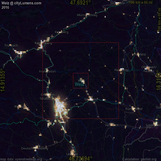
Analysis of Weiz night lights 2016
Square area 10x10 km:
 0.3%
0.3%90-99
0.89%80-89
0%70-79
0%60-69
1.19%50-59
2.23%40-49
1.34%30-39
0.74%20-29
0.45%10-19
0%0-9
92.86%Square area 50x50 km:
0.73%90-99
1.09%80-89
0.43%70-79
0.65%60-69
0.6%50-59
0.71%40-49
0.81%30-39
0.9%20-29
1.37%10-19
2.78%0-9
89.92%Clear (daylight) street map image can be seen on geolist.org.
Map coordinates:
47° 41' 31.6" North, 14° 54' 48.8" East
47° 13' 0" North, 15° 37' 0" East
46° 44' 13" North, 16° 19' 11.3" East
Some cities around Weiz sort by population:
• Graz
20.9 km =13 mi,  217°
217°
• Geidorf
19.7 km =12.2 mi, 221°
• Andritz
18.5 km =11.5 mi,  231°
231°
• Sankt Leonhard
20.3 km =12.6 mi, 216°
• Waltendorf
20.2 km =12.6 mi,  214°
214°
• Mariatrost
15.7 km =9.8 mi, 214°
• Gleisdorf
14.2 km =8.8 mi,  150°
150°
• Ries
17.9 km =11.1 mi, 213°
2761531 (p: 9,221)
Sources (retrieved 2019-11-25):
» Earth at Night: Flat Maps 2012, 2016