Santa Rosa de Río Primero night lights from space
Night Light of Santa Rosa de Río Primero (Cordoba) from space (Argentina) Src. Average luminocity for 10x10km area is 5.8022% and for 50x50km: 0.7822%.
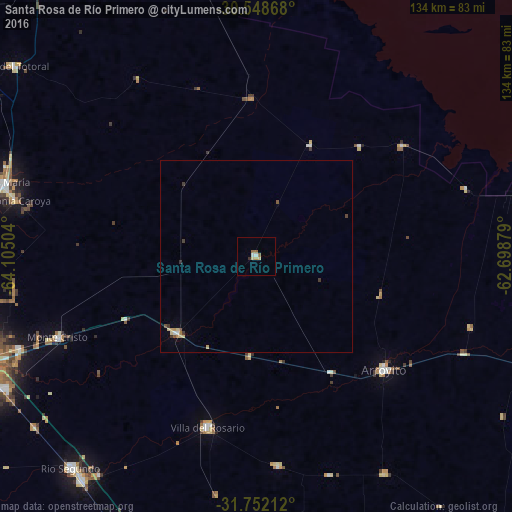
Analysis of Santa Rosa de Río Primero night lights 2016
Square area 10x10 km:
 0.73%
0.73%90-99
0.73%80-89
1.65%70-79
0.55%60-69
1.47%50-59
0.73%40-49
0%30-39
0.73%20-29
0%10-19
0%0-9
93.41%Square area 50x50 km:
0.06%90-99
0.06%80-89
0.22%70-79
0.13%60-69
0.1%50-59
0.13%40-49
0.05%30-39
0.24%20-29
0%10-19
0%0-9
99.02%Clear (daylight) street map image can be seen on geolist.org.
Map coordinates:
30° 32' 55.2" South, 64° 6' 18.1" West
31° 9' 8.3" South, 63° 24' 6.9" West
31° 45' 7.6" South, 62° 41' 55.6" West
Some cities around Santa Rosa de Río Primero sort by population:
• Jesús María
68.6 km =42.6 mi,  286°
286°
• Arroyito
44.8 km =27.8 mi,  131°
131°
• Río Segundo
73.6 km =45.7 mi,  220°
220°
• Pilar
74 km =46 mi, 217°
• Malvinas Argentinas
67.2 km =41.8 mi,  247°
247°
• Villa del Totoral
47.9 km =29.8 mi,  321°
321°
• Monte Cristo
55.8 km =34.7 mi, 247°
• Balnearia
71.7 km =44.6 mi,  77°
77°
3835938 (p: 6,788)
Sources (retrieved 2019-11-25):
» Earth at Night: Flat Maps 2012, 2016