Arroyito night lights from space
Night Light of Arroyito (Cordoba) from space (Argentina) Src. Average luminocity for 10x10km area is 15.3199% and for 50x50km: 1.1481%.
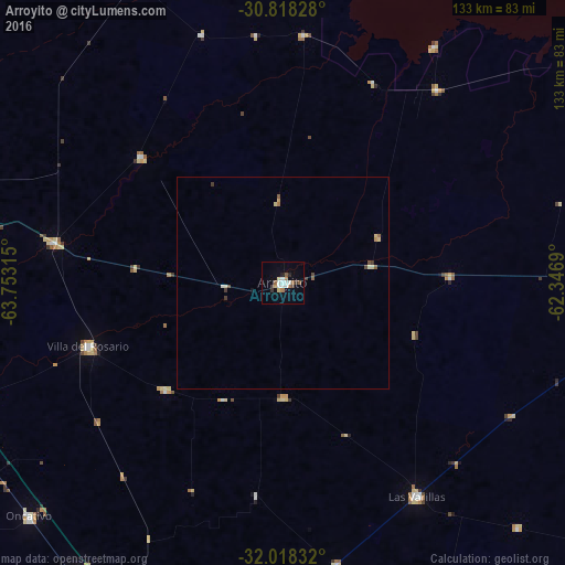
Analysis of Arroyito night lights 2016
Square area 10x10 km:
 3.32%
3.32%90-99
2.27%80-89
1.4%70-79
0.87%60-69
2.62%50-59
1.92%40-49
0.35%30-39
2.62%20-29
1.22%10-19
3.15%0-9
80.24%Square area 50x50 km:
0.15%90-99
0.15%80-89
0.2%70-79
0.09%60-69
0.15%50-59
0.21%40-49
0.12%30-39
0.26%20-29
0.05%10-19
0.16%0-9
98.46%Clear (daylight) street map image can be seen on geolist.org.
Map coordinates:
30° 49' 5.8" South, 63° 45' 11.3" West
31° 25' 12.8" South, 63° 3' 0.1" West
32° 1' 6" South, 62° 20' 48.8" West
Some cities around Arroyito sort by population:
• Las Varillas
59.2 km =36.8 mi,  148°
148°
• Oncativo
81.2 km =50.5 mi,  227°
227°
• Pilar
83.7 km =52 mi,  249°
249°
• Laguna Larga
81.4 km =50.6 mi,  240°
240°
• Santa Rosa de Río Primero
44.8 km =27.8 mi,  311°
311°
• Devoto
70.6 km =43.9 mi,  88°
88°
• Balnearia
58.5 km =36.4 mi,  38°
38°
• Pozo del Molle
67.7 km =42.1 mi,  169°
169°
3865424 (p: 19,577)
Sources (retrieved 2019-11-25):
» Earth at Night: Flat Maps 2012, 2016